|
| Mesoscale Discussion 587 |
|
< Previous MD Next MD >
|
|
Mesoscale Discussion 0587
NWS Storm Prediction Center Norman OK
0102 AM CDT Wed May 01 2024
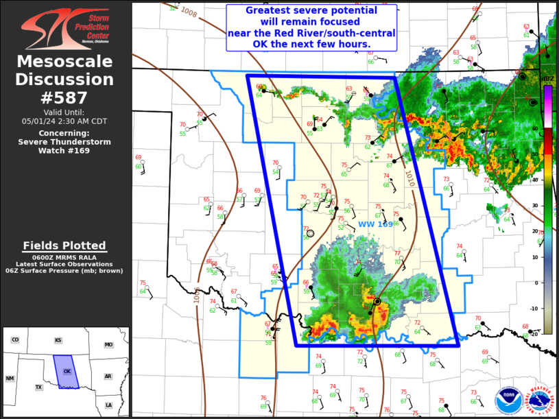
Areas affected...north-central to south-central Oklahoma
Concerning...Severe Thunderstorm Watch 169...
Valid 010602Z - 010730Z
The severe weather threat for Severe Thunderstorm Watch 169
continues.
SUMMARY...Severe thunderstorm potential will be focused across
south-central Oklahoma the next couple of hours. Strong gusts to 60
mph are possible.
DISCUSSION...Surface observations over the past 1-2 hours have
showed a considerable drop in surface dewpoints across parts of
central OK (from low/mid 60s F to mid 50s F). This is likely due to
subsidence behind earlier southwest OK storms and low-level
advection of drier boundary-layer air moving into the OKC metro
vicinity. Convection across north-central OK has largely weakened as
outflow has outpaced this activity. For both of these reasons,
severe potential will likely remain limited across the northern
two-thirds of WW 169.
A bowing segment across south-central OK produced a 62 mph gust at
the Ringling OK Mesonet site around midnight local time, with other
measured gusts around 45-50 mph more recently. As this bow continues
east over the next 1-2 hours gusts to 60 mph will remain possible.
Though, gradual weakening is expected with time and eastward extent.
..Leitman.. 05/01/2024
...Please see www.spc.noaa.gov for graphic product...
ATTN...WFO...TSA...FWD...OUN...
LAT...LON 36939674 33769587 33779816 36949890 36939674
|
|
Top/All Mesoscale Discussions/Forecast Products/Home
|
|


 @NWSSPC