|
| Mesoscale Discussion 552 |
|
< Previous MD Next MD >
|
|
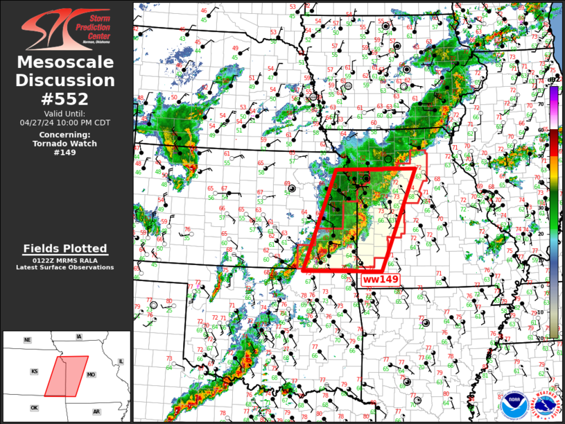
   Mesoscale Discussion 0552
   NWS Storm Prediction Center Norman OK
   0825 PM CDT Sat Apr 27 2024

   Areas affected...Southeast KS/western MO

   Concerning...Tornado Watch 149...

   Valid 280125Z - 280300Z

   The severe weather threat for Tornado Watch 149 continues.

   SUMMARY...Severe threat will gradually spread into eastern/southern
   portions of ww149.

   DISCUSSION...Slow-moving MCS has developed over eastern KS/western
   MO early this evening. A weak MCV may ultimately evolve within this
   complex near KMKC as an arcing band of convection is beginning to
   surge east across Bates/Vernon County MO. Damaging wind threat may
   increase ahead of this portion of the squall line. More discrete
   supercells trail along the southwestern flank of the MCS across
   southeast KS. As LLJ strengthens this evening, this activity should
   continue propagating slowly northeast into southwest MO. Tornado
   risk is highest with this southern flank activity.

   ..Darrow.. 04/28/2024

   ...Please see www.spc.noaa.gov for graphic product...

   ATTN...WFO...SGF...EAX...TSA...TOP...ICT...

   LAT...LON   36949634 39549531 39569269 36939380 36949634
|
|
Top/All Mesoscale Discussions/Forecast Products/Home
|
|


 @NWSSPC