Mesoscale Discussion 0520
NWS Storm Prediction Center Norman OK
1206 AM CDT Fri Apr 26 2024
Areas affected...south-central Nebraska into adjacent north-central
Kansas
Concerning...Severe Thunderstorm Watch 136...
Valid 260506Z - 260600Z
The severe weather threat for Severe Thunderstorm Watch 136
continues.
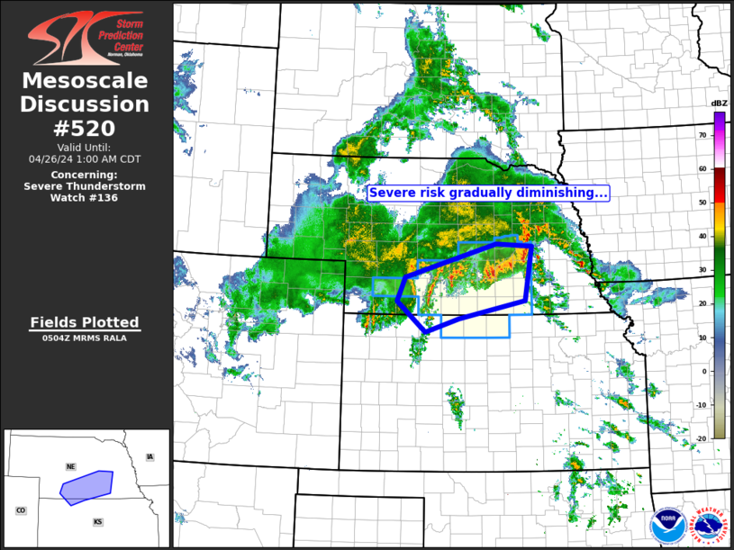
SUMMARY...Severe risk diminishing across the WW area.
DISCUSSION...Latest radar loop shows widespread, ongoing
thunderstorms across much of southern and eastern Nebraska, with
weaker/scattered -- but increasing -- convection across Kansas
northeast of the well-defined baroclinic zone. Persistent low-level
warm advection -- associated with a 50-plus kt southerly low-level
jet -- will continue to support convection overnight, given abundant
elevated instability.
With that said, severe risk continues to decrease. The strongest
storms -- organizing into a bowing MCS -- are moving across eastern
Nebraska at this time, elevated atop a 1500m deep stable layer. As
such, severe risk appears limited with these storms.
Elsewhere, convection has weakened considerably over the past hour,
and expect largely sub-severe storms to prevail the remainder of the
overnight period. Presuming trends continue to support this
scenario, WW 136 will likely be able to be cancelled prior to its
26/07Z expiration.
..Goss.. 04/26/2024
...Please see www.spc.noaa.gov for graphic product...
ATTN...WFO...OAX...GID...LBF...GLD...
LAT...LON 40250073 40720052 41359824 41309735 40279753 39929918
39660001 40250073
|


 @NWSSPC