|
| Mesoscale Discussion 461 |
|
< Previous MD Next MD >
|
|
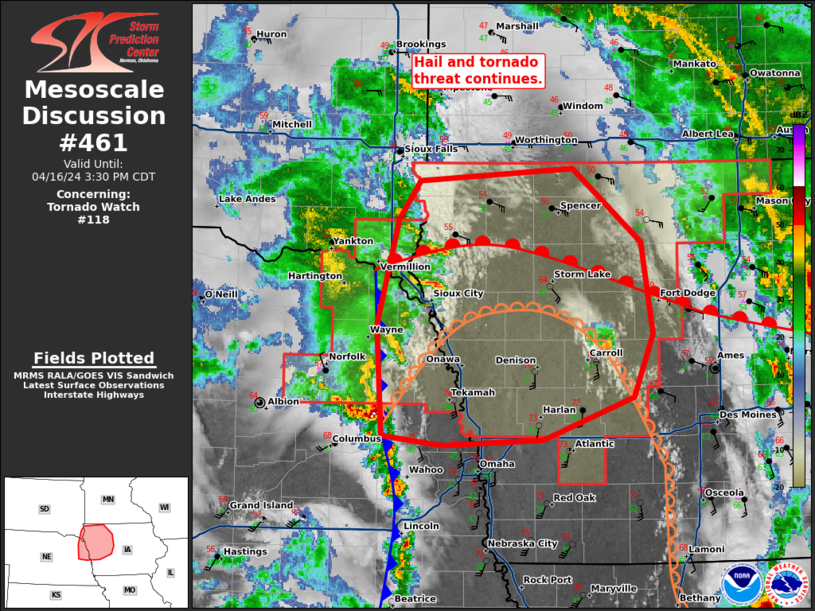
   Mesoscale Discussion 0461
   NWS Storm Prediction Center Norman OK
   0203 PM CDT Tue Apr 16 2024

   Areas affected...northeast Nebraska and northwest Iowa

   Concerning...Tornado Watch 118...

   Valid 161903Z - 162030Z

   The severe weather threat for Tornado Watch 118 continues.

   SUMMARY...The hail and tornado threat persists in tornado watch 118.

   DISCUSSION...Convection has been confined mostly near the surface
   low this morning and early afternoon beneath cool air aloft. Storms
   which have formed in the vicinity of this boundary have had several
   reports of tornadoes from what appears to be both mini-supercell and
   non-supercell processes. The Pacific Front seems to have arrived
   which should lead to an acceleration east this afternoon. A few
   tornadoes may occur as the storms continue east given the veered
   flow near the surface low.

   Across northwest Iowa, deepening cumulus has developed along the
   dryline with the first thunderstorm in Carroll County. Low-level
   flow has become mostly unidirectional on the KDMX VWP where winds
   are more southerly. However, ahead of this storm, east-southeasterly
   surface winds are present which should increase low-level SRH.
   Therefore, if this storm continues to mature, it should pose a
   threat for both large hail and a tornado or two.

   ..Bentley.. 04/16/2024

   ...Please see www.spc.noaa.gov for graphic product...

   ATTN...WFO...DMX...FSD...OAX...

   LAT...LON   41479529 41439628 41509687 42329692 43099672 43379651
               43469499 42919432 42259422 41789440 41479529
|
|
Top/All Mesoscale Discussions/Forecast Products/Home
|
|


 @NWSSPC