|
| Mesoscale Discussion 452 |
|
< Previous MD Next MD >
|
|
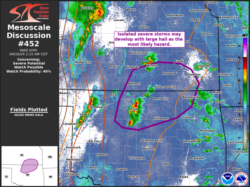
   Mesoscale Discussion 0452
   NWS Storm Prediction Center Norman OK
   0122 AM CDT Tue Apr 16 2024

   Areas affected...Northern OK and southeast KS

   Concerning...Severe potential...Watch possible

   Valid 160622Z - 160715Z

   Probability of Watch Issuance...40 percent

   SUMMARY...Isolated severe storms may develop east-northeast across
   parts of northern OK into southeast KS through the pre-dawn hours.
   Large hail appears to be the most likely hazard.

   DISCUSSION...Elevated storms gradually deepened into north-central
   OK for about an hour, but appeared to plateau over the past 15
   minutes. This activity seems to be forced by lower-level warm
   theta-e advection (greater mean mixing ratios sampled by the 00Z FWD
   sounding relative to OUN) and mid-level height falls downstream of
   the vigorous shortwave trough over southeast CO. Elevated buoyancy
   and favorable southwesterly speed shear will support a threat for at
   least marginally severe hail if cells can sustain mid-level
   rotation.

   Primary concern is whether this activity might further deepen and
   acquire low-level rotation. MLCIN at present appears sufficiently
   robust to likely mitigate that potential in the near-term. But with
   further moistening from the south-southwest coupled with adequate
   cooling around 700 mb, there is conditional potential for a storm or
   two to become more surface-based in character. While the probability
   of this appears low, should it occur, all hazards would be possible.

   ..Grams/Gleason.. 04/16/2024

   ...Please see www.spc.noaa.gov for graphic product...

   ATTN...WFO...TSA...ICT...OUN...

   LAT...LON   36749831 37629781 37859686 37809605 37629565 37219536
               36529565 36199620 35839760 35919817 36119847 36749831
|
|
Top/All Mesoscale Discussions/Forecast Products/Home
|
|


 @NWSSPC