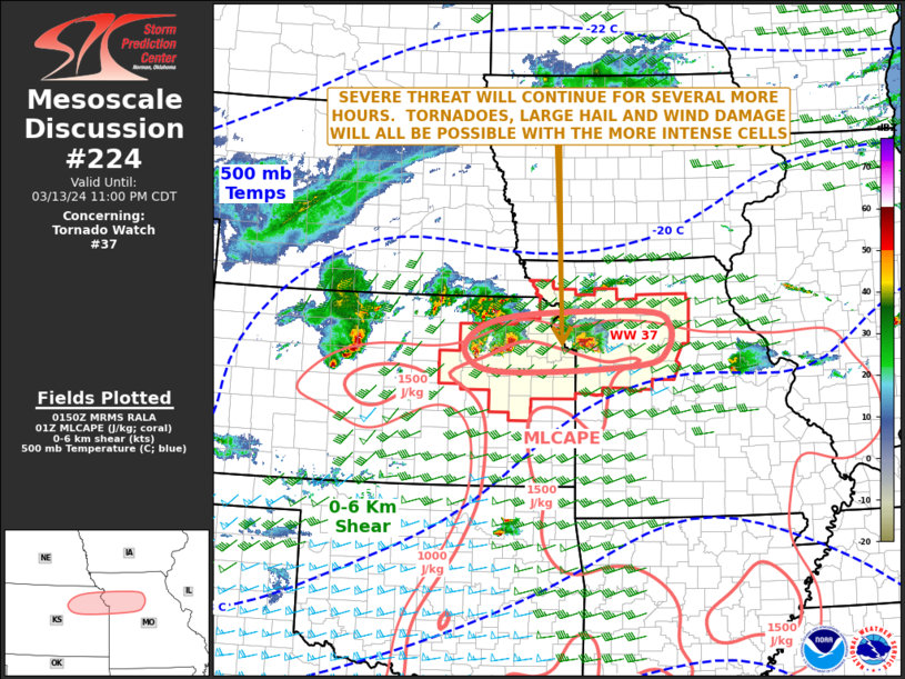
   Mesoscale Discussion 0224
   NWS Storm Prediction Center Norman OK
   0853 PM CDT Wed Mar 13 2024

   Areas affected...Northeast Kansas...Northwest Missouri

   Concerning...Tornado Watch 37...

   Valid 140153Z - 140400Z

   The severe weather threat for Tornado Watch 37 continues.

   SUMMARY...Severe storms, associated with large hail, wind damage and
   perhaps a tornado or two, will continue across parts of northeast
   Kansas and northwest Missouri. Hailstones over 2 inches in diameter
   could occur with the more intense cores.

   DISCUSSION...The latest high-resolution radar imagery from Topeka
   shows a cluster of severe storms over northeast Kansas, near and
   around the vicinity of Manhattan, Kansas. Further east, a second
   severe cluster is located near the Kansas City Metro. Both clusters
   are associated with several intense supercells that are located near
   an east-to-west warm front. These storms are likely producing large
   to very large hail. According to RAP forecast soundings, the
   environment in these areas is characterized by moderate instability
   (MLCAPE near 1500 J/kg), 0-6 km shear of 45 to 50 knots and 700-500
   mb lapse rates near 8 C/km. This continue to be favorable for
   supercells with large hail. Hailstones of greater than 2 inches in
   diameter will be possible with the more intense cores. In addition,
   low-level shear has markedly increased over the last couple of hours
   as the low-level jet has strengthened, with 0-3 km storm-relative
   helicity near 350 m2/s2. This should continue to support a tornado
   threat with the more dominant supercells, although a stabilizing
   boundary-layer will lessen the tornado threat with time. Wind damage
   will also be possible.

   ..Broyles.. 03/14/2024

   ...Please see www.spc.noaa.gov for graphic product...

   ATTN...WFO...EAX...TOP...

   LAT...LON   39679593 39779324 39549268 39149273 38919323 38819530
               38869654 39269684 39679593
|


 @NWSSPC