|
| Mesoscale Discussion 987 |
|
< Previous MD Next MD >
|
|
Mesoscale Discussion 0987
NWS Storm Prediction Center Norman OK
1149 PM CDT Wed Jun 16 2021
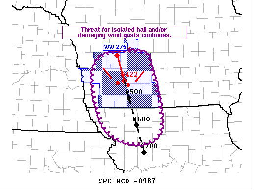
Areas affected...Southwest IA...Northwest MO
Concerning...Severe Thunderstorm Watch 275...
Valid 170449Z - 170615Z
The severe weather threat for Severe Thunderstorm Watch 275
continues.
SUMMARY...Ongoing convective line will continue to move through
southwest IA, with an attendant threat for hail and damaging wind
gusts.
DISCUSSION...The ongoing convective line has moved across much of
western IA at fairly steady storm motion around 40 kt. KDMX radar
imagery also shows the updrafts keeping pace with the cold pool,
with regional CAPPI data showing relatively stable updraft strength.
These observations suggest the convective line has reached a
favorable cold pool/updraft equilibrium for maintenance/persistence.
Given these trends, expectation is for the ongoing line to continue
for at least the next hour or two. Isolated hail and damaging wind
gusts remain possible.
Thereafter, given the displacement of the line south of the stronger
low to mid-level flow and downstream stabilization of the low-level
air mass, a gradual weakening trend is anticipated. However, some
potential exists for new development over the western portion of the
cold pool to increase/strengthen the cool pool, which would
temporarily increase wind gusts before the system weakens. Given the
uncertainties, the need for a downstream watch remains in question,
but convective trends will be monitored closely.
..Mosier/Guyer.. 06/17/2021
...Please see www.spc.noaa.gov for graphic product...
ATTN...WFO...DMX...EAX...OAX...
LAT...LON 41209557 41769530 41879411 41539380 40129352 39769425
40129519 41209557
|
|
Top/All Mesoscale Discussions/Forecast Products/Home
|
|


 @NWSSPC