|
| Mesoscale Discussion 824 |
|
< Previous MD Next MD >
|
|
Mesoscale Discussion 0824
NWS Storm Prediction Center Norman OK
1153 AM CDT Mon May 31 2021
Areas affected...Western Upper Peninsula
Concerning...Severe potential...Watch unlikely
Valid 311653Z - 311900Z
Probability of Watch Issuance...5 percent
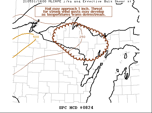
SUMMARY...Small to marginally severe (around 1 inch) hail will be
possible this afternoon. Wind gust potential will increase as
surface temperatures warm. No WW is expected.
DISCUSSION...Thunderstorms have developed ahead of a compact
shortwave trough now over the Minnesota arrowhead. These initial
storms will be capable of small to perhaps marginally severe (around
1 inch) hail. As surface temperatures continue to warm downstream of
these storms, the potential for strong/damaging wind gusts will
increase. Visible satellite also shows cumulus development along a
lake breeze front near the southern Upper Peninsula. The boundary
may serve as another focus for development later today. Even if
storms do not develop along the lake breeze front, storms that
interact with the boundary may briefly intensify. No WW is expected
today.
..Wendt/Hart.. 05/31/2021
...Please see www.spc.noaa.gov for graphic product...
ATTN...WFO...MQT...GRB...
LAT...LON 46708941 46978841 46538687 46128652 45788684 45578739
45638830 46358957 46708941
|
|
Top/All Mesoscale Discussions/Forecast Products/Home
|
|


 @NWSSPC