|
| Mesoscale Discussion 900 |
|
< Previous MD Next MD >
|
|
Mesoscale Discussion 0900
NWS Storm Prediction Center Norman OK
0140 PM CDT Thu May 30 2019
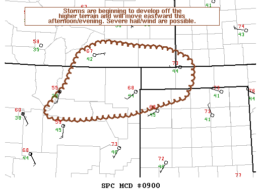
Areas affected...Raton Mesa/vicinity
Concerning...Severe potential...Watch unlikely
Valid 301840Z - 302115Z
Probability of Watch Issuance...5 percent
SUMMARY...Storms are beginning to develop over the higher terrain
and will move eastward this afternoon/evening. Isolated marginally
severe hail/wind are possible and a watch issuance is unlikely.
DISCUSSION...Per satellite imagery an upper-level shortwave trough
is moving over Arizona/New Mexico providing forcing for ascent
across the region. Insolation and weak upslope flow are helping to
drive thermal circulations along the eastern slopes of the southern
Rockies and over the Raton Mesa. Additionally, per satellite
imagery/surface observations there appears to be a surface boundary
locally enhancing convergence across southeast CO/northeast NM.
Marginal CAPE (250-750 J/kg of MLCAPE per mesoanalysis/forecast
soundings) and deep boundary-layer mixing will drive the severe
threat given the weak low/mid-level shear. An isolated severe threat
for marginally severe hail/wind exists this afternoon/evening across
the area, thus a watch issuance is unlikely.
..Nauslar/Grams.. 05/30/2019
...Please see www.spc.noaa.gov for graphic product...
ATTN...WFO...DDC...AMA...PUB...ABQ...
LAT...LON 36330176 35950328 35820473 35840552 35950567 36550512
37070488 37310474 37560410 37460319 37400229 37220175
37080157 36690158 36330176
|
|
Top/All Mesoscale Discussions/Forecast Products/Home
|
|


 @NWSSPC