Note:
The expiration time in the watch graphic is amended if the watch is
replaced, cancelled or extended.
Note:
Note:
The expiration time in the watch graphic is amended if the watch is
replaced, cancelled or extended.
Note: Click for
Watch Status Reports.
   SEL9

   URGENT - IMMEDIATE BROADCAST REQUESTED
   Severe Thunderstorm Watch Number 359
   NWS Storm Prediction Center Norman OK
   350 AM CDT Fri May 31 2024

   The NWS Storm Prediction Center has issued a

   * Severe Thunderstorm Watch for portions of
     Southeast Texas
     Coastal Waters

   * Effective this Friday morning from 350 AM until 1100 AM CDT.

   * Primary threats include...
     Scattered damaging winds and isolated significant gusts to 75
       mph possible
     Isolated large hail events to 1.5 inches in diameter possible
     A tornado or two possible

   SUMMARY...A squall line with embedded bowing segments will likely
   persist through the morning as the storms move across Southeast
   Texas (including the College Station and Houston metro areas) to the
   upper Texas coast.  Damaging winds of 60-75 mph will be the main
   threat, though the strongest storms could produce isolated large
   hail of 1-1.5 inches in diameter.  An isolated tornado or two may
   also occur with circulations embedded in the line.

   The severe thunderstorm watch area is approximately along and 75
   statute miles north and south of a line from 35 miles west of
   College Station TX to 15 miles north northeast of Galveston TX. For
   a complete depiction of the watch see the associated watch outline
   update (WOUS64 KWNS WOU9).

   PRECAUTIONARY/PREPAREDNESS ACTIONS...

   REMEMBER...A Severe Thunderstorm Watch means conditions are
   favorable for severe thunderstorms in and close to the watch area.
   Persons in these areas should be on the lookout for threatening
   weather conditions and listen for later statements and possible
   warnings. Severe thunderstorms can and occasionally do produce
   tornadoes.

   &&

   OTHER WATCH INFORMATION...CONTINUE...WW 358...

   AVIATION...A few severe thunderstorms with hail surface and aloft to
   1.5 inches. Extreme turbulence and surface wind gusts to 65 knots. A
   few cumulonimbi with maximum tops to 550. Mean storm motion vector
   31040.

   ...Thompson
 Note:
The Aviation Watch (SAW) product is an approximation to the watch area.
The actual watch is depicted by the shaded areas.
Note:
The Aviation Watch (SAW) product is an approximation to the watch area.
The actual watch is depicted by the shaded areas.
   SAW9
   WW 359 SEVERE TSTM TX CW 310850Z - 311600Z
   AXIS..75 STATUTE MILES NORTH AND SOUTH OF LINE..
   35W CLL/COLLEGE STATION TX/ - 15NNE GLS/GALVESTON TX/
   ..AVIATION COORDS.. 65NM N/S /32ENE CWK - 44SE IAH/
   HAIL SURFACE AND ALOFT..1.5 INCHES. WIND GUSTS..65 KNOTS.
   MAX TOPS TO 550. MEAN STORM MOTION VECTOR 31040.

   LAT...LON 31669696 30629465 28459465 29499696

   THIS IS AN APPROXIMATION TO THE WATCH AREA.  FOR A
   COMPLETE DEPICTION OF THE WATCH SEE WOUS64 KWNS
   FOR WOU9.
Watch 359 Status Report Messages:
STATUS REPORT #4 ON WW 359
VALID 311515Z - 311600Z
SEVERE WEATHER THREAT CONTINUES RIGHT OF A LINE FROM 60 SSE LBX
TO 10 W BPT.
WW 359 WILL BE ALLOWED TO EXPIRE AT 311600Z.
..DEAN..05/31/24
ATTN...WFO...HGX...
&&
STATUS REPORT FOR WS 359
SEVERE WEATHER THREAT CONTINUES FOR THE FOLLOWING AREAS
GMZ355-311600-
CW
. ADJACENT COASTAL WATERS INCLUDED ARE
THE WATCH STATUS MESSAGE IS FOR GUIDANCE PURPOSES ONLY. PLEASE
REFER TO WATCH COUNTY NOTIFICATION STATEMENTS FOR OFFICIAL
INFORMATION ON COUNTIES...INDEPENDENT CITIES AND MARINE ZONES
CLEARED FROM SEVERE THUNDERSTORM AND TORNADO WATCHES.
$$
STATUS REPORT #3 ON WW 359
VALID 311415Z - 311540Z
SEVERE WEATHER THREAT CONTINUES RIGHT OF A LINE FROM 60 N VCT TO
25 SW GLS TO 20 NNE GLS TO 30 SSE LFK.
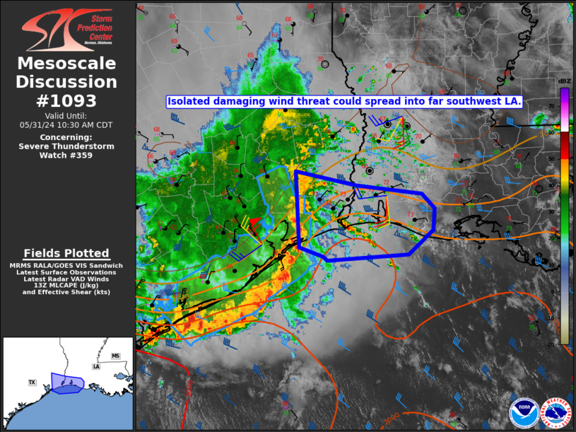
FOR ADDITIONAL INFORMATION SEE MESOSCALE DISCUSSION 1093
..DEAN..05/31/24
ATTN...WFO...HGX...
&&
STATUS REPORT FOR WS 359
SEVERE WEATHER THREAT CONTINUES FOR THE FOLLOWING AREAS
TXC039-071-167-321-311540-
TX
. TEXAS COUNTIES INCLUDED ARE
BRAZORIA CHAMBERS GALVESTON
MATAGORDA
$$
GMZ330-350-355-311540-
CW
. ADJACENT COASTAL WATERS INCLUDED ARE
MATAGORDA BAY
COASTAL WATERS FROM FREEPORT TO MATAGORDA SHIP CHANNEL TX OUT 20
NM
COASTAL WATERS FROM HIGH ISLAND TO FREEPORT TX OUT 20 NM
$$
THE WATCH STATUS MESSAGE IS FOR GUIDANCE PURPOSES ONLY. PLEASE
REFER TO WATCH COUNTY NOTIFICATION STATEMENTS FOR OFFICIAL
INFORMATION ON COUNTIES...INDEPENDENT CITIES AND MARINE ZONES
CLEARED FROM SEVERE THUNDERSTORM AND TORNADO WATCHES.
$$
STATUS REPORT #2 ON WW 359
VALID 311240Z - 311340Z
SEVERE WEATHER THREAT CONTINUES RIGHT OF A LINE FROM 55 N VCT TO
35 NW LBX TO 15 N HOU TO 20 ENE UTS.
..GRAMS..05/31/24
ATTN...WFO...HGX...
&&
STATUS REPORT FOR WS 359
SEVERE WEATHER THREAT CONTINUES FOR THE FOLLOWING AREAS
TXC039-071-157-167-201-239-291-321-373-407-481-311340-
TX
. TEXAS COUNTIES INCLUDED ARE
BRAZORIA CHAMBERS FORT BEND
GALVESTON HARRIS JACKSON
LIBERTY MATAGORDA POLK
SAN JACINTO WHARTON
$$
GMZ330-335-350-355-311340-
CW
. ADJACENT COASTAL WATERS INCLUDED ARE
MATAGORDA BAY
GALVESTON BAY
COASTAL WATERS FROM FREEPORT TO MATAGORDA SHIP CHANNEL TX OUT 20
NM
COASTAL WATERS FROM HIGH ISLAND TO FREEPORT TX OUT 20 NM
$$
THE WATCH STATUS MESSAGE IS FOR GUIDANCE PURPOSES ONLY. PLEASE
REFER TO WATCH COUNTY NOTIFICATION STATEMENTS FOR OFFICIAL
INFORMATION ON COUNTIES...INDEPENDENT CITIES AND MARINE ZONES
CLEARED FROM SEVERE THUNDERSTORM AND TORNADO WATCHES.
$$
STATUS REPORT #1 ON WW 359
VALID 311030Z - 311140Z
SEVERE WEATHER THREAT CONTINUES RIGHT OF A LINE FROM 30 W CLL TO
50 NNE CLL.
..GRAMS..05/31/24
ATTN...WFO...HGX...
&&
STATUS REPORT FOR WS 359
SEVERE WEATHER THREAT CONTINUES FOR THE FOLLOWING AREAS
TXC015-039-041-051-071-089-157-167-185-201-225-239-291-313-321-
339-373-407-455-471-473-477-481-311140-
TX
. TEXAS COUNTIES INCLUDED ARE
AUSTIN BRAZORIA BRAZOS
BURLESON CHAMBERS COLORADO
FORT BEND GALVESTON GRIMES
HARRIS HOUSTON JACKSON
LIBERTY MADISON MATAGORDA
MONTGOMERY POLK SAN JACINTO
TRINITY WALKER WALLER
WASHINGTON WHARTON
$$
GMZ330-335-350-355-311140-
CW
. ADJACENT COASTAL WATERS INCLUDED ARE
MATAGORDA BAY
GALVESTON BAY
COASTAL WATERS FROM FREEPORT TO MATAGORDA SHIP CHANNEL TX OUT 20
NM
COASTAL WATERS FROM HIGH ISLAND TO FREEPORT TX OUT 20 NM
$$
THE WATCH STATUS MESSAGE IS FOR GUIDANCE PURPOSES ONLY. PLEASE
REFER TO WATCH COUNTY NOTIFICATION STATEMENTS FOR OFFICIAL
INFORMATION ON COUNTIES...INDEPENDENT CITIES AND MARINE ZONES
CLEARED FROM SEVERE THUNDERSTORM AND TORNADO WATCHES.
$$
Note:
Click for Complete Product Text.
Tornadoes
Probability of 2 or more tornadoes
|
Low (20%)
|
Probability of 1 or more strong (EF2-EF5) tornadoes
|
Low (<2%)
|
Wind
Probability of 10 or more severe wind events
|
Mod (50%)
|
Probability of 1 or more wind events > 65 knots
|
Mod (30%)
|
Hail
Probability of 10 or more severe hail events
|
Low (20%)
|
Probability of 1 or more hailstones > 2 inches
|
Low (10%)
|
Combined Severe Hail/Wind
Probability of 6 or more combined severe hail/wind events
|
High (70%)
|
For each watch, probabilities for particular events inside the watch
(listed above in each table) are determined by the issuing forecaster.
The "Low" category contains probability values ranging from less than 2%
to 20% (EF2-EF5 tornadoes), less than 5% to 20% (all other probabilities),
"Moderate" from 30% to 60%, and "High" from 70% to greater than 95%.
High values are bolded and lighter in color to provide awareness of
an increased threat for a particular event.


 @NWSSPC