Note:
The expiration time in the watch graphic is amended if the watch is
replaced, cancelled or extended.
Note:
Note:
The expiration time in the watch graphic is amended if the watch is
replaced, cancelled or extended.
Note: Click for
Watch Status Reports.
SEL2
URGENT - IMMEDIATE BROADCAST REQUESTED
Severe Thunderstorm Watch Number 332
NWS Storm Prediction Center Norman OK
715 AM EDT Mon May 27 2024
The NWS Storm Prediction Center has issued a
* Severe Thunderstorm Watch for portions of
Central and northern Georgia
Western South Carolina
* Effective this Monday morning and afternoon from 715 AM until
200 PM EDT.
* Primary threats include...
Scattered damaging wind gusts to 70 mph possible
Isolated large hail events to 1 inch in diameter possible
A tornado or two possible
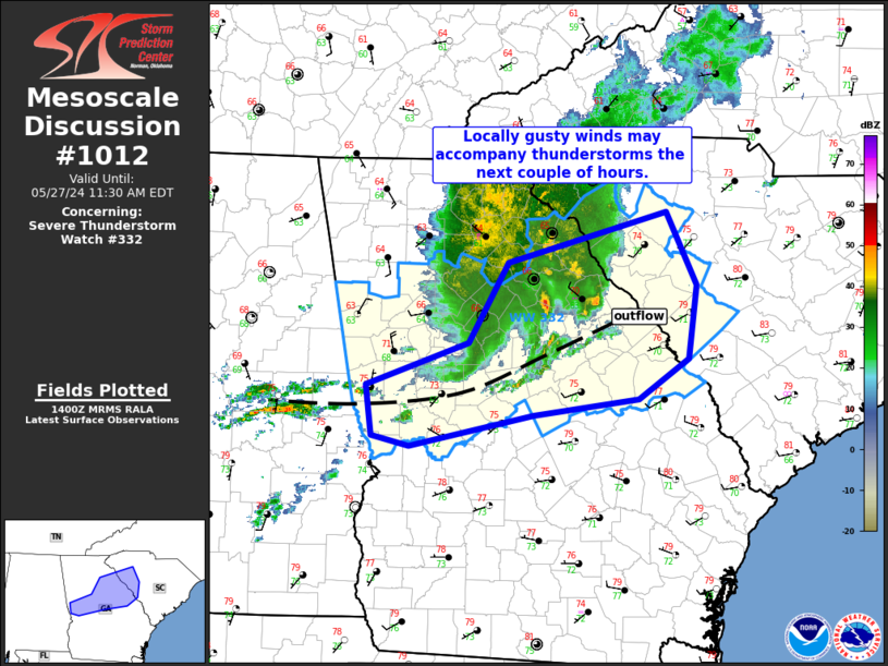
SUMMARY...Merging parts of two convective complexes will shift east
out of Alabama, while some re-intensification is possible for the
eastern one in eastern GA and western SC. Damaging wind is the main
threat, though a tornado and/or isolated hail may occur.
The severe thunderstorm watch area is approximately along and 50
statute miles north and south of a line from 15 miles north
northwest of La Grange GA to 35 miles north northeast of Augusta GA.
For a complete depiction of the watch see the associated watch
outline update (WOUS64 KWNS WOU2).
PRECAUTIONARY/PREPAREDNESS ACTIONS...
REMEMBER...A Severe Thunderstorm Watch means conditions are
favorable for severe thunderstorms in and close to the watch area.
Persons in these areas should be on the lookout for threatening
weather conditions and listen for later statements and possible
warnings. Severe thunderstorms can and occasionally do produce
tornadoes.
&&
OTHER WATCH INFORMATION...CONTINUE...WW 331...
AVIATION...A few severe thunderstorms with hail surface and aloft to
1 inch. Extreme turbulence and surface wind gusts to 60 knots. A few
cumulonimbi with maximum tops to 500. Mean storm motion vector
28035.
...Edwards

   SEL2

   URGENT - IMMEDIATE BROADCAST REQUESTED
   Severe Thunderstorm Watch Number 332
   NWS Storm Prediction Center Norman OK
   715 AM EDT Mon May 27 2024

   The NWS Storm Prediction Center has issued a

   * Severe Thunderstorm Watch for portions of
     Central and northern Georgia
     Western South Carolina

   * Effective this Monday morning and afternoon from 715 AM until
     200 PM EDT.

   * Primary threats include...
     Scattered damaging wind gusts to 70 mph possible
     Isolated large hail events to 1 inch in diameter possible
     A tornado or two possible

   SUMMARY...Merging parts of two convective complexes will shift east
   out of Alabama, while some re-intensification is possible for the
   eastern one in eastern GA and western SC.  Damaging wind is the main
   threat, though a tornado and/or isolated hail may occur.

   The severe thunderstorm watch area is approximately along and 50
   statute miles north and south of a line from 15 miles north
   northwest of La Grange GA to 35 miles north northeast of Augusta GA.
   For a complete depiction of the watch see the associated watch
   outline update (WOUS64 KWNS WOU2).

   PRECAUTIONARY/PREPAREDNESS ACTIONS...

   REMEMBER...A Severe Thunderstorm Watch means conditions are
   favorable for severe thunderstorms in and close to the watch area.
   Persons in these areas should be on the lookout for threatening
   weather conditions and listen for later statements and possible
   warnings. Severe thunderstorms can and occasionally do produce
   tornadoes.

   &&

   OTHER WATCH INFORMATION...CONTINUE...WW 331...

   AVIATION...A few severe thunderstorms with hail surface and aloft to
   1 inch. Extreme turbulence and surface wind gusts to 60 knots. A few
   cumulonimbi with maximum tops to 500. Mean storm motion vector
   28035.

   ...Edwards
 Note:
The Aviation Watch (SAW) product is an approximation to the watch area.
The actual watch is depicted by the shaded areas.
Note:
The Aviation Watch (SAW) product is an approximation to the watch area.
The actual watch is depicted by the shaded areas.
   SAW2
   WW 332 SEVERE TSTM GA SC 271115Z - 271800Z
   AXIS..50 STATUTE MILES NORTH AND SOUTH OF LINE..
   15NNW LGC/LA GRANGE GA/ - 35NNE AGS/AUGUSTA GA/
   ..AVIATION COORDS.. 45NM N/S /9NNE LGC - 22ENE IRQ/
   HAIL SURFACE AND ALOFT..1 INCH. WIND GUSTS..60 KNOTS.
   MAX TOPS TO 500. MEAN STORM MOTION VECTOR 28035.

   LAT...LON 33918517 34558174 33098174 32488517

   THIS IS AN APPROXIMATION TO THE WATCH AREA.  FOR A
   COMPLETE DEPICTION OF THE WATCH SEE WOUS64 KWNS
   FOR WOU2.
Watch 332 Status Report Messages:
STATUS REPORT #3 ON WW 332

VALID 271610Z - 271740Z

SEVERE WEATHER THREAT CONTINUES RIGHT OF A LINE FROM 15 W LGC TO
35 SSE ATL TO 45 WNW AGS TO 30 SSW AGS.

..LEITMAN..05/27/24

ATTN...WFO...FFC...CAE...GSP...

&&

STATUS REPORT FOR WS 332

SEVERE WEATHER THREAT CONTINUES FOR THE FOLLOWING AREAS

GAC009-021-079-125-133-141-145-159-163-169-171-199-207-215-231-
237-263-265-269-285-293-301-303-319-271740-

GA
.    GEORGIA COUNTIES INCLUDED ARE

BALDWIN 	     BIBB		 CRAWFORD
GLASCOCK	     GREENE		 HANCOCK
HARRIS		     JASPER		 JEFFERSON
JONES		     LAMAR		 MERIWETHER
MONROE		     MUSCOGEE		 PIKE
PUTNAM		     TALBOT		 TALIAFERRO
TAYLOR		     TROUP		 UPSON
WARREN		     WASHINGTON 	 WILKINSON
$$


THE WATCH STATUS MESSAGE IS FOR GUIDANCE PURPOSES ONLY.  PLEASE
REFER TO WATCH COUNTY NOTIFICATION STATEMENTS FOR OFFICIAL
INFORMATION ON COUNTIES...INDEPENDENT CITIES AND MARINE ZONES
CLEARED FROM SEVERE THUNDERSTORM AND TORNADO WATCHES.
$$

STATUS REPORT #2 ON WW 332

VALID 271340Z - 271440Z

SEVERE WEATHER THREAT CONTINUES RIGHT OF A LINE FROM 15 W LGC TO
40 NNW MCN TO 25 NNW AHN.

..LEITMAN..05/27/24

ATTN...WFO...FFC...CAE...GSP...

&&

STATUS REPORT FOR WS 332

SEVERE WEATHER THREAT CONTINUES FOR THE FOLLOWING AREAS

GAC009-021-033-059-073-079-105-119-125-133-141-145-147-159-163-
169-171-181-189-195-199-207-211-215-219-221-231-237-245-263-265-
269-285-293-301-303-317-319-271440-

GA
.    GEORGIA COUNTIES INCLUDED ARE

BALDWIN 	     BIBB		 BURKE
CLARKE		     COLUMBIA		 CRAWFORD
ELBERT		     FRANKLIN		 GLASCOCK
GREENE		     HANCOCK		 HARRIS
HART		     JASPER		 JEFFERSON
JONES		     LAMAR		 LINCOLN
MCDUFFIE	     MADISON		 MERIWETHER
MONROE		     MORGAN		 MUSCOGEE
OCONEE		     OGLETHORPE 	 PIKE
PUTNAM		     RICHMOND		 TALBOT
TALIAFERRO	     TAYLOR		 TROUP
UPSON		     WARREN		 WASHINGTON
WILKES		     WILKINSON
$$


SCC001-003-007-037-047-059-065-081-271440-

SC
.    SOUTH CAROLINA COUNTIES INCLUDED ARE

ABBEVILLE	     AIKEN		 ANDERSON
EDGEFIELD	     GREENWOOD		 LAURENS
MCCORMICK	     SALUDA
$$


THE WATCH STATUS MESSAGE IS FOR GUIDANCE PURPOSES ONLY.  PLEASE
REFER TO WATCH COUNTY NOTIFICATION STATEMENTS FOR OFFICIAL
INFORMATION ON COUNTIES...INDEPENDENT CITIES AND MARINE ZONES
CLEARED FROM SEVERE THUNDERSTORM AND TORNADO WATCHES.
$$

STATUS REPORT #1 ON WW 332

VALID 271140Z - 271240Z

THE SEVERE WEATHER THREAT CONTINUES ACROSS THE ENTIRE WATCH AREA.

..GOSS..05/27/24

ATTN...WFO...FFC...CAE...GSP...

&&

STATUS REPORT FOR WS 332

SEVERE WEATHER THREAT CONTINUES FOR THE FOLLOWING AREAS

GAC009-021-033-035-045-059-063-067-073-077-079-089-097-105-113-
119-121-125-133-135-141-143-145-147-149-151-159-163-169-171-181-
189-195-199-207-211-215-217-219-221-231-237-245-247-255-263-265-
269-285-293-297-301-303-317-319-271240-

GA
.    GEORGIA COUNTIES INCLUDED ARE

BALDWIN 	     BIBB		 BURKE
BUTTS		     CARROLL		 CLARKE
CLAYTON 	     COBB		 COLUMBIA
COWETA		     CRAWFORD		 DEKALB
DOUGLAS 	     ELBERT		 FAYETTE
FRANKLIN	     FULTON		 GLASCOCK
GREENE		     GWINNETT		 HANCOCK
HARALSON	     HARRIS		 HART
HEARD		     HENRY		 JASPER
JEFFERSON	     JONES		 LAMAR
LINCOLN 	     MCDUFFIE		 MADISON
MERIWETHER	     MONROE		 MORGAN
MUSCOGEE	     NEWTON		 OCONEE
OGLETHORPE	     PIKE		 PUTNAM
RICHMOND	     ROCKDALE		 SPALDING
TALBOT		     TALIAFERRO 	 TAYLOR
TROUP		     UPSON		 WALTON
WARREN		     WASHINGTON 	 WILKES
WILKINSON
$$


SCC001-003-007-037-047-059-065-081-271240-

SC
.    SOUTH CAROLINA COUNTIES INCLUDED ARE

ABBEVILLE	     AIKEN		 ANDERSON
EDGEFIELD	     GREENWOOD		 LAURENS
MCCORMICK	     SALUDA
$$


THE WATCH STATUS MESSAGE IS FOR GUIDANCE PURPOSES ONLY.  PLEASE
REFER TO WATCH COUNTY NOTIFICATION STATEMENTS FOR OFFICIAL
INFORMATION ON COUNTIES...INDEPENDENT CITIES AND MARINE ZONES
CLEARED FROM SEVERE THUNDERSTORM AND TORNADO WATCHES.
$$
Note:
Click for Complete Product Text.
Tornadoes
Probability of 2 or more tornadoes
|
Low (20%)
|
Probability of 1 or more strong (EF2-EF5) tornadoes
|
Low (5%)
|
Wind
Probability of 10 or more severe wind events
|
Mod (40%)
|
Probability of 1 or more wind events > 65 knots
|
Low (20%)
|
Hail
Probability of 10 or more severe hail events
|
Mod (30%)
|
Probability of 1 or more hailstones > 2 inches
|
Low (20%)
|
Combined Severe Hail/Wind
Probability of 6 or more combined severe hail/wind events
|
Mod (60%)
|
For each watch, probabilities for particular events inside the watch
(listed above in each table) are determined by the issuing forecaster.
The "Low" category contains probability values ranging from less than 2%
to 20% (EF2-EF5 tornadoes), less than 5% to 20% (all other probabilities),
"Moderate" from 30% to 60%, and "High" from 70% to greater than 95%.
High values are bolded and lighter in color to provide awareness of
an increased threat for a particular event.


 @NWSSPC