 Note:
The expiration time in the watch graphic is amended if the watch is
replaced, cancelled or extended.
Note:
Note:
The expiration time in the watch graphic is amended if the watch is
replaced, cancelled or extended.
Note: Click for
Watch Status Reports.
SEL4
URGENT - IMMEDIATE BROADCAST REQUESTED
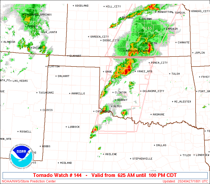
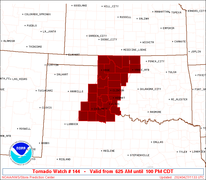
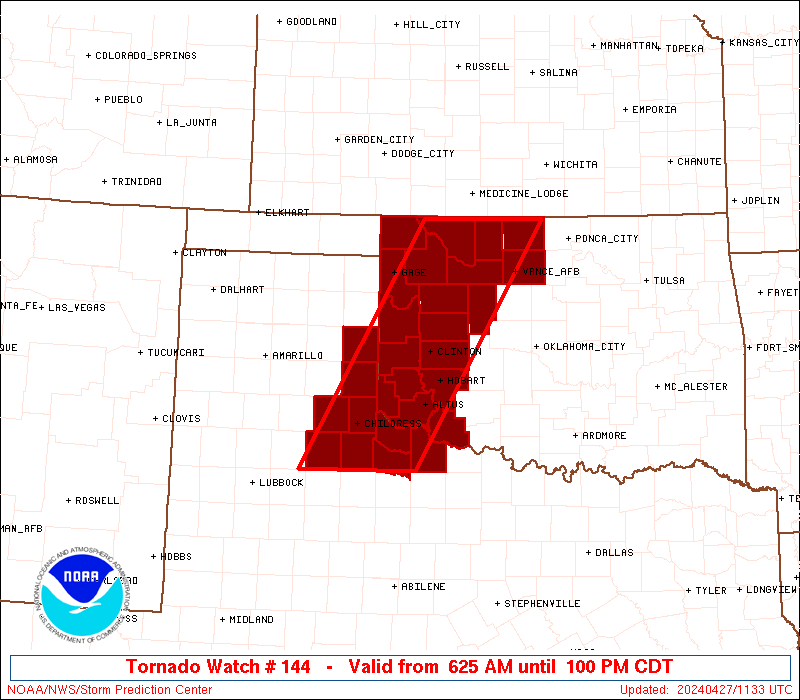
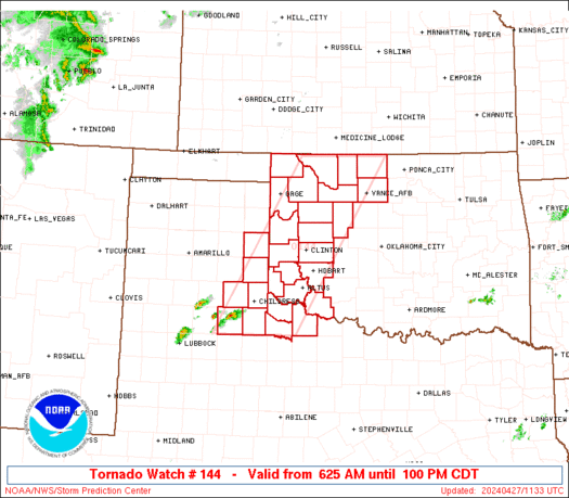
Tornado Watch Number 144
NWS Storm Prediction Center Norman OK
915 PM CDT Fri Apr 18 2025
The NWS Storm Prediction Center has issued a
* Tornado Watch for portions of
Southern Oklahoma
Western North Texas
* Effective this Friday night and Saturday morning from 915 PM
until 400 AM CDT.
* Primary threats include...
A couple tornadoes possible
Scattered large hail likely with isolated very large hail events
to 2 inches in diameter possible
Scattered damaging wind gusts to 70 mph possible
SUMMARY...Strong to severe thunderstorms will continue to develop
through mid/late evening. Large hail and damaging winds can be
expected along with some tornado potential with storms near/south of
a boundary across the region.
The tornado watch area is approximately along and 65 statute miles
north and south of a line from 80 miles west southwest of Wichita
Falls TX to 70 miles north northeast of Durant OK. For a complete
depiction of the watch see the associated watch outline update
(WOUS64 KWNS WOU4).
PRECAUTIONARY/PREPAREDNESS ACTIONS...
REMEMBER...A Tornado Watch means conditions are favorable for
tornadoes and severe thunderstorms in and close to the watch
area. Persons in these areas should be on the lookout for
threatening weather conditions and listen for later statements
and possible warnings.
&&
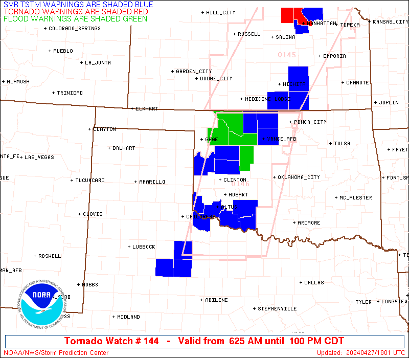
OTHER WATCH INFORMATION...CONTINUE...WW 143...
AVIATION...Tornadoes and a few severe thunderstorms with hail
surface and aloft to 2 inches. Extreme turbulence and surface wind
gusts to 60 knots. A few cumulonimbi with maximum tops to 500. Mean
storm motion vector 23030.
...Guyer
 Note:
The Aviation Watch (SAW) product is an approximation to the watch area.
The actual watch is depicted by the shaded areas.
Note:
The Aviation Watch (SAW) product is an approximation to the watch area.
The actual watch is depicted by the shaded areas.
   SAW4
   WW 144 TORNADO OK TX 190215Z - 190900Z
   AXIS..65 STATUTE MILES NORTH AND SOUTH OF LINE..
   80WSW SPS/WICHITA FALLS TX/ - 70NNE DUA/DURANT OK/
   ..AVIATION COORDS.. 55NM N/S /57SSE CDS - 8WNW MLC/
   HAIL SURFACE AND ALOFT..2 INCHES. WIND GUSTS..60 KNOTS.
   MAX TOPS TO 500. MEAN STORM MOTION VECTOR 23030.

   LAT...LON 34469978 35839593 33939593 32589978

   THIS IS AN APPROXIMATION TO THE WATCH AREA.  FOR A
   COMPLETE DEPICTION OF THE WATCH SEE WOUS64 KWNS
   FOR WOU4.
Watch 144 Status Report Messages:
STATUS REPORT #3 ON WW 144

VALID 190650Z - 190740Z

SEVERE WEATHER THREAT CONTINUES RIGHT OF A LINE FROM 15 WNW ABI
TO 5 ESE SPS TO 30 SSW TUL.

..BROYLES..04/19/25

ATTN...WFO...OUN...FWD...SJT...

&&

STATUS REPORT FOR WT 144

SEVERE WEATHER THREAT CONTINUES FOR THE FOLLOWING AREAS

OKC005-019-029-063-067-069-085-095-099-123-133-190740-

OK
.    OKLAHOMA COUNTIES INCLUDED ARE

ATOKA		     CARTER		 COAL
HUGHES		     JEFFERSON		 JOHNSTON
LOVE		     MARSHALL		 MURRAY
PONTOTOC	     SEMINOLE
$$


TXC009-077-097-237-337-363-417-429-447-503-190740-

TX
.    TEXAS COUNTIES INCLUDED ARE

ARCHER		     CLAY		 COOKE
JACK		     MONTAGUE		 PALO PINTO
SHACKELFORD	     STEPHENS		 THROCKMORTON
YOUNG
$$


THE WATCH STATUS MESSAGE IS FOR GUIDANCE PURPOSES ONLY.  PLEASE
REFER TO WATCH COUNTY NOTIFICATION STATEMENTS FOR OFFICIAL
INFORMATION ON COUNTIES...INDEPENDENT CITIES AND MARINE ZONES
CLEARED FROM SEVERE THUNDERSTORM AND TORNADO WATCHES.
$$

STATUS REPORT #2 ON WW 144

VALID 190540Z - 190640Z

THE SEVERE WEATHER THREAT CONTINUES ACROSS THE ENTIRE WATCH AREA.

..BROYLES..04/19/25

ATTN...WFO...OUN...FWD...SJT...

&&

STATUS REPORT FOR WT 144

SEVERE WEATHER THREAT CONTINUES FOR THE FOLLOWING AREAS

OKC005-019-029-031-033-049-063-067-069-085-095-099-123-125-133-
137-141-190640-

OK
.    OKLAHOMA COUNTIES INCLUDED ARE

ATOKA		     CARTER		 COAL
COMANCHE	     COTTON		 GARVIN
HUGHES		     JEFFERSON		 JOHNSTON
LOVE		     MARSHALL		 MURRAY
PONTOTOC	     POTTAWATOMIE	 SEMINOLE
STEPHENS	     TILLMAN
$$


TXC009-023-077-097-207-237-275-337-363-417-429-447-485-487-503-
190640-

TX
.    TEXAS COUNTIES INCLUDED ARE

ARCHER		     BAYLOR		 CLAY
COOKE		     HASKELL		 JACK
KNOX		     MONTAGUE		 PALO PINTO
SHACKELFORD	     STEPHENS		 THROCKMORTON
WICHITA 	     WILBARGER		 YOUNG
$$


THE WATCH STATUS MESSAGE IS FOR GUIDANCE PURPOSES ONLY.  PLEASE
REFER TO WATCH COUNTY NOTIFICATION STATEMENTS FOR OFFICIAL
INFORMATION ON COUNTIES...INDEPENDENT CITIES AND MARINE ZONES
CLEARED FROM SEVERE THUNDERSTORM AND TORNADO WATCHES.
$$

STATUS REPORT #1 ON WW 144

VALID 190320Z - 190440Z

THE SEVERE WEATHER THREAT CONTINUES ACROSS THE ENTIRE WATCH AREA.

..BENTLEY..04/19/25

ATTN...WFO...OUN...FWD...SJT...

&&

STATUS REPORT FOR WT 144

SEVERE WEATHER THREAT CONTINUES FOR THE FOLLOWING AREAS

OKC005-019-029-031-033-049-063-067-069-085-095-099-123-125-133-
137-141-190440-

OK
.    OKLAHOMA COUNTIES INCLUDED ARE

ATOKA		     CARTER		 COAL
COMANCHE	     COTTON		 GARVIN
HUGHES		     JEFFERSON		 JOHNSTON
LOVE		     MARSHALL		 MURRAY
PONTOTOC	     POTTAWATOMIE	 SEMINOLE
STEPHENS	     TILLMAN
$$


TXC009-023-077-097-207-237-275-337-363-417-429-447-485-487-503-
190440-

TX
.    TEXAS COUNTIES INCLUDED ARE

ARCHER		     BAYLOR		 CLAY
COOKE		     HASKELL		 JACK
KNOX		     MONTAGUE		 PALO PINTO
SHACKELFORD	     STEPHENS		 THROCKMORTON
WICHITA 	     WILBARGER		 YOUNG
$$


THE WATCH STATUS MESSAGE IS FOR GUIDANCE PURPOSES ONLY.  PLEASE
REFER TO WATCH COUNTY NOTIFICATION STATEMENTS FOR OFFICIAL
INFORMATION ON COUNTIES...INDEPENDENT CITIES AND MARINE ZONES
CLEARED FROM SEVERE THUNDERSTORM AND TORNADO WATCHES.
$$
Note:
Click for Complete Product Text.
Tornadoes
Probability of 2 or more tornadoes
|
Mod (40%)
|
Probability of 1 or more strong (EF2-EF5) tornadoes
|
Low (20%)
|
Wind
Probability of 10 or more severe wind events
|
Mod (50%)
|
Probability of 1 or more wind events > 65 knots
|
Low (20%)
|
Hail
Probability of 10 or more severe hail events
|
Mod (60%)
|
Probability of 1 or more hailstones > 2 inches
|
Mod (50%)
|
Combined Severe Hail/Wind
Probability of 6 or more combined severe hail/wind events
|
High (90%)
|
For each watch, probabilities for particular events inside the watch
(listed above in each table) are determined by the issuing forecaster.
The "Low" category contains probability values ranging from less than 2%
to 20% (EF2-EF5 tornadoes), less than 5% to 20% (all other probabilities),
"Moderate" from 30% to 60%, and "High" from 70% to greater than 95%.
High values are bolded and lighter in color to provide awareness of
an increased threat for a particular event.


 @NWSSPC