Note:
The expiration time in the watch graphic is amended if the watch is
replaced, cancelled or extended.
Note:
Note:
The expiration time in the watch graphic is amended if the watch is
replaced, cancelled or extended.
Note: Click for
Watch Status Reports.
SEL2
URGENT - IMMEDIATE BROADCAST REQUESTED
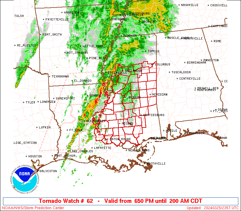
Severe Thunderstorm Watch Number 62
NWS Storm Prediction Center Norman OK
550 PM CDT Sun Mar 23 2025
The NWS Storm Prediction Center has issued a
* Severe Thunderstorm Watch for portions of
Central Texas
* Effective this Sunday afternoon and Monday morning from 550 PM
until 100 AM CDT.
* Primary threats include...
Scattered large hail likely with isolated very large hail events
to 2.5 inches in diameter possible
Scattered damaging wind gusts to 70 mph possible
SUMMARY...Thunderstorms are expected to continue developing along a
cold front through the evening, while posing a threat for mainly
scattered large hail up to 1.5-2.5 inches in diameter. Some risk for
strong to severe winds, potentially up to 60-70 mph, will also exist
if small clusters can form.
The severe thunderstorm watch area is approximately along and 55
statute miles north and south of a line from 65 miles west of Austin
TX to 70 miles north northeast of Huntsville TX. For a complete
depiction of the watch see the associated watch outline update
(WOUS64 KWNS WOU2).
PRECAUTIONARY/PREPAREDNESS ACTIONS...
REMEMBER...A Severe Thunderstorm Watch means conditions are
favorable for severe thunderstorms in and close to the watch area.
Persons in these areas should be on the lookout for threatening
weather conditions and listen for later statements and possible
warnings. Severe thunderstorms can and occasionally do produce
tornadoes.
&&
OTHER WATCH INFORMATION...CONTINUE...WW 60...WW 61...
AVIATION...A few severe thunderstorms with hail surface and aloft to
2.5 inches. Extreme turbulence and surface wind gusts to 60 knots. A
few cumulonimbi with maximum tops to 500. Mean storm motion vector
27030.
...Gleason

   SEL2

   URGENT - IMMEDIATE BROADCAST REQUESTED
   Severe Thunderstorm Watch Number 62
   NWS Storm Prediction Center Norman OK
   550 PM CDT Sun Mar 23 2025

   The NWS Storm Prediction Center has issued a

   * Severe Thunderstorm Watch for portions of
     Central Texas

   * Effective this Sunday afternoon and Monday morning from 550 PM
     until 100 AM CDT.

   * Primary threats include...
     Scattered large hail likely with isolated very large hail events
       to 2.5 inches in diameter possible
     Scattered damaging wind gusts to 70 mph possible

   SUMMARY...Thunderstorms are expected to continue developing along a
   cold front through the evening, while posing a threat for mainly
   scattered large hail up to 1.5-2.5 inches in diameter. Some risk for
   strong to severe winds, potentially up to 60-70 mph, will also exist
   if small clusters can form.

   The severe thunderstorm watch area is approximately along and 55
   statute miles north and south of a line from 65 miles west of Austin
   TX to 70 miles north northeast of Huntsville TX. For a complete
   depiction of the watch see the associated watch outline update
   (WOUS64 KWNS WOU2).

   PRECAUTIONARY/PREPAREDNESS ACTIONS...

   REMEMBER...A Severe Thunderstorm Watch means conditions are
   favorable for severe thunderstorms in and close to the watch area.
   Persons in these areas should be on the lookout for threatening
   weather conditions and listen for later statements and possible
   warnings. Severe thunderstorms can and occasionally do produce
   tornadoes.

   &&

   OTHER WATCH INFORMATION...CONTINUE...WW 60...WW 61...

   AVIATION...A few severe thunderstorms with hail surface and aloft to
   2.5 inches. Extreme turbulence and surface wind gusts to 60 knots. A
   few cumulonimbi with maximum tops to 500. Mean storm motion vector
   27030.

   ...Gleason
 Note:
The Aviation Watch (SAW) product is an approximation to the watch area.
The actual watch is depicted by the shaded areas.
Note:
The Aviation Watch (SAW) product is an approximation to the watch area.
The actual watch is depicted by the shaded areas.
   SAW2
   WW 62 SEVERE TSTM TX 232250Z - 240600Z
   AXIS..55 STATUTE MILES NORTH AND SOUTH OF LINE..
   65W AUS/AUSTIN TX/ - 70NNE UTS/HUNTSVILLE TX/
   ..AVIATION COORDS.. 50NM N/S /43NNW SAT - 34NNW LFK/
   HAIL SURFACE AND ALOFT..2.5 INCHES. WIND GUSTS..60 KNOTS.
   MAX TOPS TO 500. MEAN STORM MOTION VECTOR 27030.

   LAT...LON 31099879 32469501 30879501 29509879

   THIS IS AN APPROXIMATION TO THE WATCH AREA.  FOR A
   COMPLETE DEPICTION OF THE WATCH SEE WOUS64 KWNS
   FOR WOU2.
Watch 62 Status Report Messages:
STATUS REPORT #5 ON WW 62
VALID 240440Z - 240600Z
SEVERE WEATHER THREAT CONTINUES RIGHT OF A LINE FROM 25 SSW SAT
TO 20 SSE BAZ TO 35 E BAZ TO 45 ESE AUS TO 25 W CLL TO 30 NW CLL
TO 40 N CLL TO 40 SSE TYR TO 35 SSW GGG.
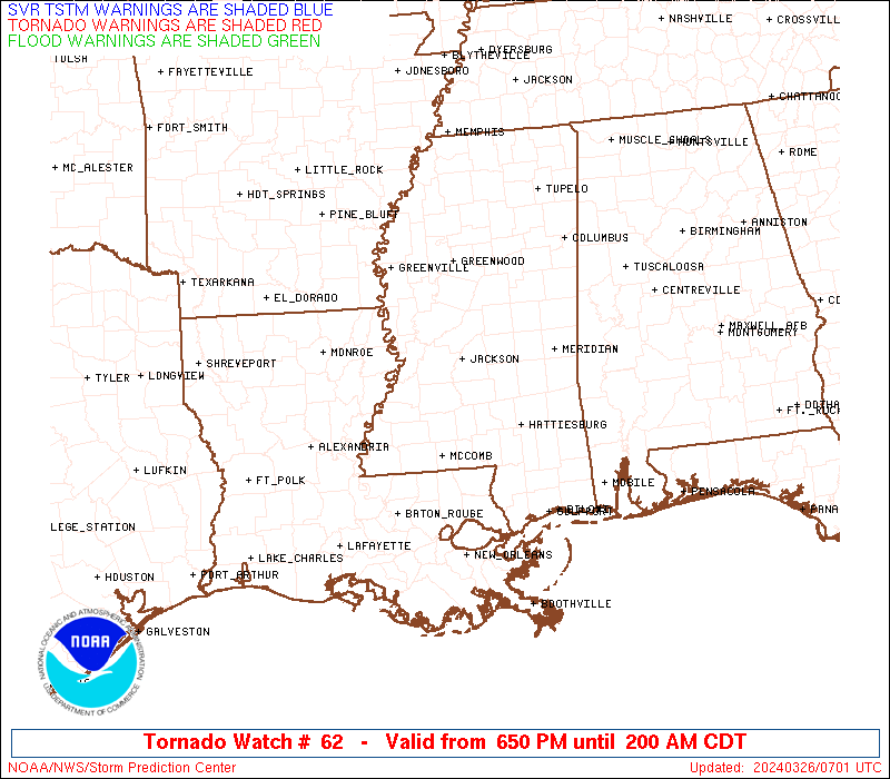
WW 62 WILL BE ALLOWED TO EXPIRE AT 240600Z.
..JEWELL..03/24/25
ATTN...WFO...FWD...EWX...HGX...
&&
STATUS REPORT FOR WS 62
SEVERE WEATHER THREAT CONTINUES FOR THE FOLLOWING AREAS
TXC041-051-055-185-187-225-289-313-395-455-471-477-240600-
TX
. TEXAS COUNTIES INCLUDED ARE
BRAZOS BURLESON CALDWELL
GRIMES GUADALUPE HOUSTON
LEON MADISON ROBERTSON
TRINITY WALKER WASHINGTON
$$
THE WATCH STATUS MESSAGE IS FOR GUIDANCE PURPOSES ONLY. PLEASE
REFER TO WATCH COUNTY NOTIFICATION STATEMENTS FOR OFFICIAL
INFORMATION ON COUNTIES...INDEPENDENT CITIES AND MARINE ZONES
CLEARED FROM SEVERE THUNDERSTORM AND TORNADO WATCHES.
$$
STATUS REPORT #4 ON WW 62
VALID 240400Z - 240540Z
SEVERE WEATHER THREAT CONTINUES RIGHT OF A LINE FROM 5 ENE HDO TO
15 NNE SAT TO 20 SSW AUS TO 15 NNE AUS TO 25 SSW TPL TO 50 S CRS
TO 35 SSW GGG.
..JEWELL..03/24/25
ATTN...WFO...FWD...EWX...HGX...
&&
STATUS REPORT FOR WS 62
SEVERE WEATHER THREAT CONTINUES FOR THE FOLLOWING AREAS
TXC021-029-041-051-055-091-185-187-209-225-287-289-313-331-395-
453-455-471-477-491-240540-
TX
. TEXAS COUNTIES INCLUDED ARE
BASTROP BEXAR BRAZOS
BURLESON CALDWELL COMAL
GRIMES GUADALUPE HAYS
HOUSTON LEE LEON
MADISON MILAM ROBERTSON
TRAVIS TRINITY WALKER
WASHINGTON WILLIAMSON
$$
THE WATCH STATUS MESSAGE IS FOR GUIDANCE PURPOSES ONLY. PLEASE
REFER TO WATCH COUNTY NOTIFICATION STATEMENTS FOR OFFICIAL
INFORMATION ON COUNTIES...INDEPENDENT CITIES AND MARINE ZONES
CLEARED FROM SEVERE THUNDERSTORM AND TORNADO WATCHES.
$$
STATUS REPORT #3 ON WW 62
VALID 240250Z - 240340Z
SEVERE WEATHER THREAT CONTINUES RIGHT OF A LINE FROM 45 NW SAT TO
40 NW BAZ TO 25 W AUS TO 25 SW TPL TO 30 S CRS TO 35 SW TYR TO 10
SSW TYR TO 20 NW GGG.
..JEWELL..03/24/25
ATTN...WFO...FWD...EWX...HGX...
&&
STATUS REPORT FOR WS 62
SEVERE WEATHER THREAT CONTINUES FOR THE FOLLOWING AREAS
TXC001-019-021-027-029-041-051-055-091-145-161-185-187-209-225-
259-287-289-293-313-331-395-453-455-471-477-491-240340-
TX
. TEXAS COUNTIES INCLUDED ARE
ANDERSON BANDERA BASTROP
BELL BEXAR BRAZOS
BURLESON CALDWELL COMAL
FALLS FREESTONE GRIMES
GUADALUPE HAYS HOUSTON
KENDALL LEE LEON
LIMESTONE MADISON MILAM
ROBERTSON TRAVIS TRINITY
WALKER WASHINGTON WILLIAMSON
$$
THE WATCH STATUS MESSAGE IS FOR GUIDANCE PURPOSES ONLY. PLEASE
REFER TO WATCH COUNTY NOTIFICATION STATEMENTS FOR OFFICIAL
INFORMATION ON COUNTIES...INDEPENDENT CITIES AND MARINE ZONES
CLEARED FROM SEVERE THUNDERSTORM AND TORNADO WATCHES.
$$
STATUS REPORT #2 ON WW 62
VALID 240155Z - 240240Z
THE SEVERE WEATHER THREAT CONTINUES ACROSS THE ENTIRE WATCH AREA.
FOR ADDITIONAL INFORMATION SEE MESOSCALE DISCUSSION 258
..JEWELL..03/24/25
ATTN...WFO...FWD...EWX...HGX...
&&
STATUS REPORT FOR WS 62
SEVERE WEATHER THREAT CONTINUES FOR THE FOLLOWING AREAS
TXC001-019-021-027-029-031-041-051-053-055-091-099-145-161-171-
185-187-209-213-225-259-265-281-287-289-293-299-309-313-331-349-
395-453-455-471-477-491-240240-
TX
. TEXAS COUNTIES INCLUDED ARE
ANDERSON BANDERA BASTROP
BELL BEXAR BLANCO
BRAZOS BURLESON BURNET
CALDWELL COMAL CORYELL
FALLS FREESTONE GILLESPIE
GRIMES GUADALUPE HAYS
HENDERSON HOUSTON KENDALL
KERR LAMPASAS LEE
LEON LIMESTONE LLANO
MCLENNAN MADISON MILAM
NAVARRO ROBERTSON TRAVIS
TRINITY WALKER WASHINGTON
WILLIAMSON
$$
THE WATCH STATUS MESSAGE IS FOR GUIDANCE PURPOSES ONLY. PLEASE
REFER TO WATCH COUNTY NOTIFICATION STATEMENTS FOR OFFICIAL
INFORMATION ON COUNTIES...INDEPENDENT CITIES AND MARINE ZONES
CLEARED FROM SEVERE THUNDERSTORM AND TORNADO WATCHES.
$$
STATUS REPORT #1 ON WW 62
VALID 240015Z - 240140Z
THE SEVERE WEATHER THREAT CONTINUES ACROSS THE ENTIRE WATCH AREA.
..JEWELL..03/24/25
ATTN...WFO...FWD...EWX...HGX...
&&
STATUS REPORT FOR WS 62
SEVERE WEATHER THREAT CONTINUES FOR THE FOLLOWING AREAS
TXC001-021-027-031-041-051-053-055-091-099-145-161-171-185-187-
209-213-225-259-281-287-289-293-299-309-313-331-349-395-453-455-
471-477-491-240140-
TX
. TEXAS COUNTIES INCLUDED ARE
ANDERSON BASTROP BELL
BLANCO BRAZOS BURLESON
BURNET CALDWELL COMAL
CORYELL FALLS FREESTONE
GILLESPIE GRIMES GUADALUPE
HAYS HENDERSON HOUSTON
KENDALL LAMPASAS LEE
LEON LIMESTONE LLANO
MCLENNAN MADISON MILAM
NAVARRO ROBERTSON TRAVIS
TRINITY WALKER WASHINGTON
WILLIAMSON
$$
THE WATCH STATUS MESSAGE IS FOR GUIDANCE PURPOSES ONLY. PLEASE
REFER TO WATCH COUNTY NOTIFICATION STATEMENTS FOR OFFICIAL
INFORMATION ON COUNTIES...INDEPENDENT CITIES AND MARINE ZONES
CLEARED FROM SEVERE THUNDERSTORM AND TORNADO WATCHES.
$$
Note:
Click for Complete Product Text.
Tornadoes
Probability of 2 or more tornadoes
|
Low (<5%)
|
Probability of 1 or more strong (EF2-EF5) tornadoes
|
Low (<2%)
|
Wind
Probability of 10 or more severe wind events
|
Mod (40%)
|
Probability of 1 or more wind events > 65 knots
|
Low (20%)
|
Hail
Probability of 10 or more severe hail events
|
Mod (60%)
|
Probability of 1 or more hailstones > 2 inches
|
Mod (40%)
|
Combined Severe Hail/Wind
Probability of 6 or more combined severe hail/wind events
|
High (80%)
|
For each watch, probabilities for particular events inside the watch
(listed above in each table) are determined by the issuing forecaster.
The "Low" category contains probability values ranging from less than 2%
to 20% (EF2-EF5 tornadoes), less than 5% to 20% (all other probabilities),
"Moderate" from 30% to 60%, and "High" from 70% to greater than 95%.
High values are bolded and lighter in color to provide awareness of
an increased threat for a particular event.


 @NWSSPC