|
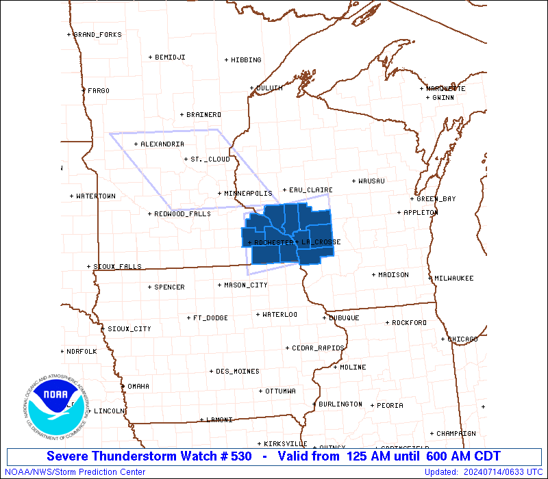
Initial List of Counties in SPC Severe Thunderstorm Watch 530 (WOU)
|
Back to Watch 530
|
 |
   WOUS64 KWNS 140625
   WOU0

   BULLETIN - IMMEDIATE BROADCAST REQUESTED
   SEVERE THUNDERSTORM WATCH OUTLINE UPDATE FOR WS 530
   NWS STORM PREDICTION CENTER NORMAN OK
   125 AM CDT SUN JUL 14 2024

   SEVERE THUNDERSTORM WATCH 530 IS IN EFFECT UNTIL 600 AM CDT
   FOR THE FOLLOWING LOCATIONS

   MNC045-055-109-157-169-141100-
   /O.NEW.KWNS.SV.A.0530.240714T0625Z-240714T1100Z/

   MN
   .    MINNESOTA COUNTIES INCLUDED ARE

   FILLMORE             HOUSTON             OLMSTED
   WABASHA              WINONA


   WIC011-053-063-081-121-123-141100-
   /O.NEW.KWNS.SV.A.0530.240714T0625Z-240714T1100Z/

   WI
   .    WISCONSIN COUNTIES INCLUDED ARE

   BUFFALO              JACKSON             LA CROSSE
   MONROE               TREMPEALEAU         VERNON


   ATTN...WFO...ARX...
|
| Aviation Watch (SAW) for WW530 |
|---|
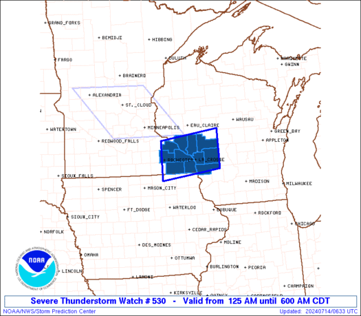 |
| Note:
The Aviation Watch (SAW) product is an approximation to the watch area.
The actual watch is depicted by the shaded areas. |
   SAW0
   WW 530 SEVERE TSTM MN WI 140625Z - 141100Z
   AXIS..40 STATUTE MILES NORTH AND SOUTH OF LINE..
   5WSW RST/ROCHESTER MN/ - 50ENE LSE/LA CROSSE WI/
   ..AVIATION COORDS.. 35NM N/S /49W ODI - 44NNW DLL/
   HAIL SURFACE AND ALOFT..2 INCHES. WIND GUSTS..60 KNOTS.
   MAX TOPS TO 550. MEAN STORM MOTION VECTOR 31040.

   LAT...LON 44479259 44739032 43579032 43319259

   THIS IS AN APPROXIMATION TO THE WATCH AREA.  FOR A
   COMPLETE DEPICTION OF THE WATCH SEE WOUS64 KWNS
   FOR WOU0.
|
|


 @NWSSPC