|
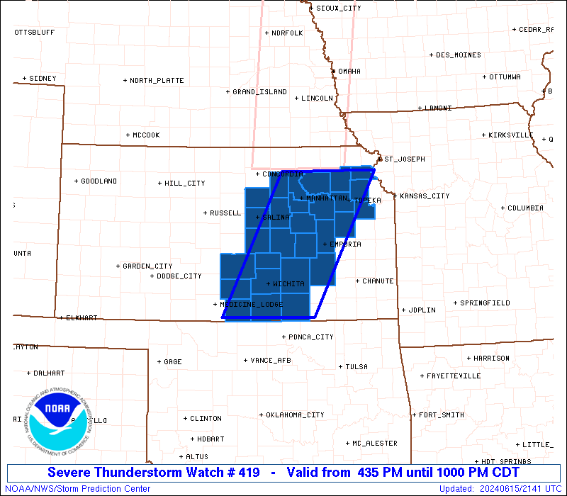
Initial List of Counties in SPC Severe Thunderstorm Watch 419 (WOU)
|
Back to Watch 419
|
 |
   WOUS64 KWNS 152132
   WOU9

   BULLETIN - IMMEDIATE BROADCAST REQUESTED
   SEVERE THUNDERSTORM WATCH OUTLINE UPDATE FOR WS 419
   NWS STORM PREDICTION CENTER NORMAN OK
   435 PM CDT SAT JUN 15 2024

   SEVERE THUNDERSTORM WATCH 419 IS IN EFFECT UNTIL 1000 PM CDT
   FOR THE FOLLOWING LOCATIONS

   KSC005-015-017-027-035-041-045-061-073-077-079-085-087-095-111-
   113-115-127-139-143-149-155-161-169-173-177-191-197-160300-
   /O.NEW.KWNS.SV.A.0419.240615T2135Z-240616T0300Z/

   KS
   .    KANSAS COUNTIES INCLUDED ARE

   ATCHISON             BUTLER              CHASE
   CLAY                 COWLEY              DICKINSON
   DOUGLAS              GEARY               GREENWOOD
   HARPER               HARVEY              JACKSON
   JEFFERSON            KINGMAN             LYON
   MARION               MCPHERSON           MORRIS
   OSAGE                OTTAWA              POTTAWATOMIE
   RENO                 RILEY               SALINE
   SEDGWICK             SHAWNEE             SUMNER
   WABAUNSEE


   ATTN...WFO...EAX...TOP...ICT...
|
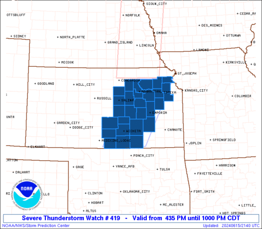
| Aviation Watch (SAW) for WW419 |
|---|
 |
| Note:
The Aviation Watch (SAW) product is an approximation to the watch area.
The actual watch is depicted by the shaded areas. |
   SAW9
   WW 419 SEVERE TSTM KS 152135Z - 160300Z
   AXIS..55 STATUTE MILES EAST AND WEST OF LINE..
   45NE MHK/MANHATTAN KS/ - 40S ICT/WICHITA KS/
   ..AVIATION COORDS.. 50NM E/W /37S PWE - 41S ICT/
   HAIL SURFACE AND ALOFT..1.5 INCHES. WIND GUSTS..70 KNOTS.
   MAX TOPS TO 450. MEAN STORM MOTION VECTOR 21030.

   LAT...LON 39589504 37079643 37079843 39589711

   THIS IS AN APPROXIMATION TO THE WATCH AREA.  FOR A
   COMPLETE DEPICTION OF THE WATCH SEE WOUS64 KWNS
   FOR WOU9.
|
|


 @NWSSPC