|
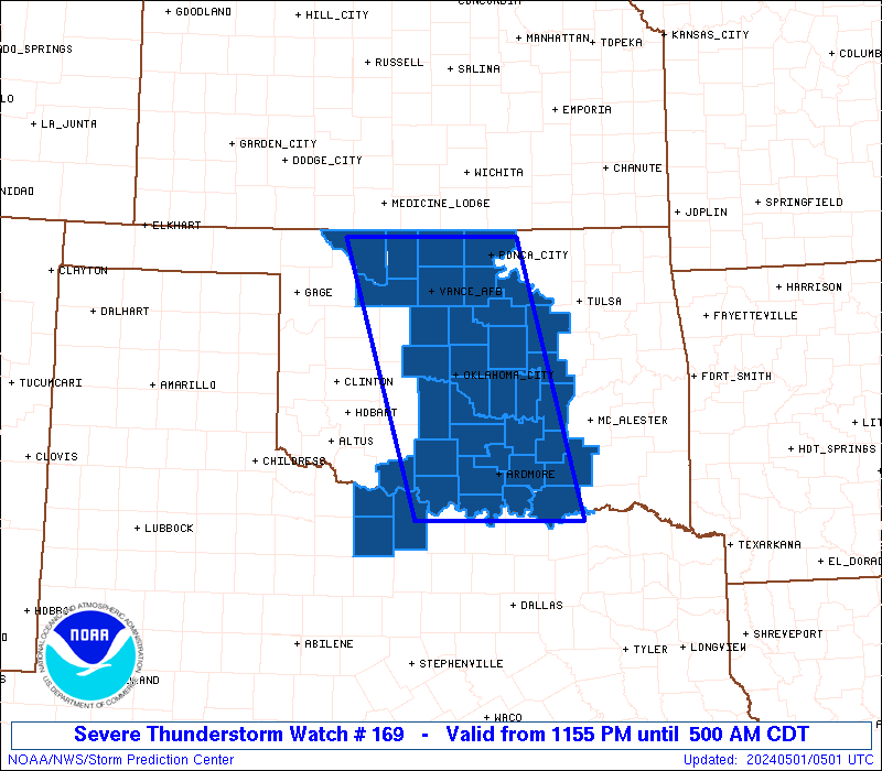
Initial List of Counties in SPC Severe Thunderstorm Watch 169 (WOU)
|
Back to Watch 169
|
 |
   WOUS64 KWNS 010453
   WOU9

   BULLETIN - IMMEDIATE BROADCAST REQUESTED
   SEVERE THUNDERSTORM WATCH OUTLINE UPDATE FOR WS 169
   NWS STORM PREDICTION CENTER NORMAN OK
   1155 PM CDT TUE APR 30 2024

   SEVERE THUNDERSTORM WATCH 169 IS IN EFFECT UNTIL 500 AM CDT
   FOR THE FOLLOWING LOCATIONS

   OKC003-005-013-017-019-027-029-033-037-047-049-051-053-063-067-
   069-071-073-081-083-085-087-093-095-099-103-107-109-117-119-123-
   125-133-137-151-011000-
   /O.NEW.KWNS.SV.A.0169.240501T0455Z-240501T1000Z/

   OK
   .    OKLAHOMA COUNTIES INCLUDED ARE

   ALFALFA              ATOKA               BRYAN
   CANADIAN             CARTER              CLEVELAND
   COAL                 COTTON              CREEK
   GARFIELD             GARVIN              GRADY
   GRANT                HUGHES              JEFFERSON
   JOHNSTON             KAY                 KINGFISHER
   LINCOLN              LOGAN               LOVE
   MAJOR                MARSHALL            MCCLAIN
   MURRAY               NOBLE               OKFUSKEE
   OKLAHOMA             PAWNEE              PAYNE
   PONTOTOC             POTTAWATOMIE        SEMINOLE
   STEPHENS             WOODS


   TXC009-077-485-011000-
   /O.NEW.KWNS.SV.A.0169.240501T0455Z-240501T1000Z/

   TX
   .    TEXAS COUNTIES INCLUDED ARE

   ARCHER               CLAY                WICHITA


   ATTN...WFO...OUN...TSA...
|
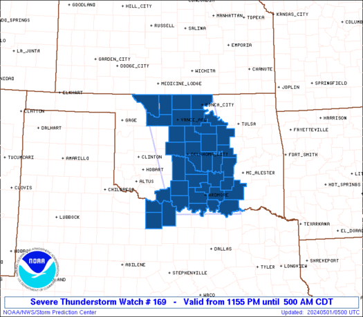
| Aviation Watch (SAW) for WW169 |
|---|
 |
| Note:
The Aviation Watch (SAW) product is an approximation to the watch area.
The actual watch is depicted by the shaded areas. |
   SAW9
   WW 169 SEVERE TSTM OK TX 010455Z - 011000Z
   AXIS..65 STATUTE MILES EAST AND WEST OF LINE..
   40N END/ENID OK/ - 35S ADM/ARDMORE OK/
   ..AVIATION COORDS.. 55NM E/W /35N END - 27SSE ADM/
   HAIL SURFACE AND ALOFT..2 INCHES. WIND GUSTS..60 KNOTS.
   MAX TOPS TO 450. MEAN STORM MOTION VECTOR 30025.

   LAT...LON 36919674 33789589 33789815 36919910

   THIS IS AN APPROXIMATION TO THE WATCH AREA.  FOR A
   COMPLETE DEPICTION OF THE WATCH SEE WOUS64 KWNS
   FOR WOU9.
|
|


 @NWSSPC