|
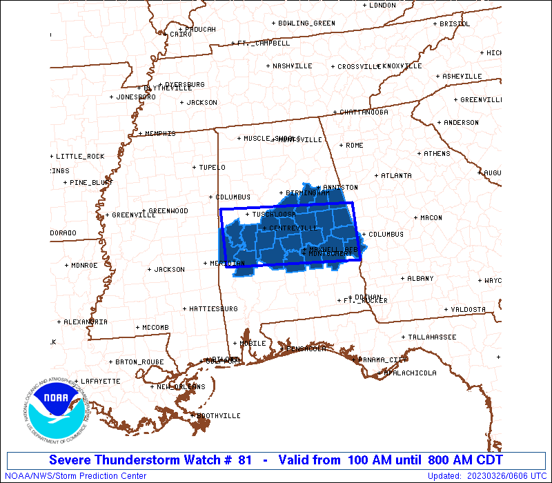
Initial List of Counties in SPC Severe Thunderstorm Watch 81 (WOU)
|
Back to Watch 81
|
 |
   WOUS64 KWNS 260558
   WOU1

   BULLETIN - IMMEDIATE BROADCAST REQUESTED
   SEVERE THUNDERSTORM WATCH OUTLINE UPDATE FOR WS 81
   NWS STORM PREDICTION CENTER NORMAN OK
   100 AM CDT SUN MAR 26 2023

   SEVERE THUNDERSTORM WATCH 81 IS IN EFFECT UNTIL 800 AM CDT
   FOR THE FOLLOWING LOCATIONS

   ALC001-007-011-017-021-027-037-047-051-063-065-081-085-087-091-
   101-105-111-113-117-119-121-123-261300-
   /O.NEW.KWNS.SV.A.0081.230326T0600Z-230326T1300Z/

   AL
   .    ALABAMA COUNTIES INCLUDED ARE

   AUTAUGA              BIBB                BULLOCK
   CHAMBERS             CHILTON             CLAY
   COOSA                DALLAS              ELMORE
   GREENE               HALE                LEE
   LOWNDES              MACON               MARENGO
   MONTGOMERY           PERRY               RANDOLPH
   RUSSELL              SHELBY              SUMTER
   TALLADEGA            TALLAPOOSA


   ATTN...WFO...BMX...
|
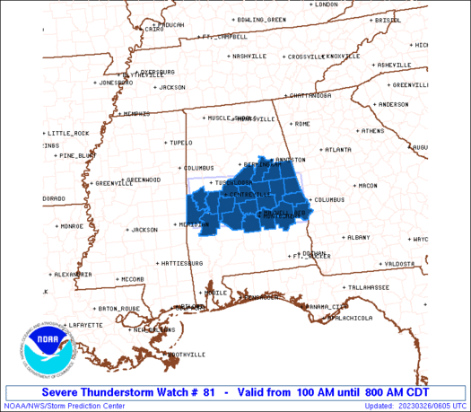
| Aviation Watch (SAW) for WW81 |
|---|
 |
| Note:
The Aviation Watch (SAW) product is an approximation to the watch area.
The actual watch is depicted by the shaded areas. |
   SAW1
   WW 81 SEVERE TSTM AL 260600Z - 261300Z
   AXIS..40 STATUTE MILES NORTH AND SOUTH OF LINE..
   20E AUO/AUBURN AL/ - 80WNW SEM/SELMA AL/
   ..AVIATION COORDS.. 35NM N/S /27SSE LGC - 37NE MEI/
   HAIL SURFACE AND ALOFT..2.5 INCHES. WIND GUSTS..55 KNOTS.
   MAX TOPS TO 500. MEAN STORM MOTION VECTOR 24035.

   LAT...LON 32038509 32218825 33378825 33188509

   THIS IS AN APPROXIMATION TO THE WATCH AREA.  FOR A
   COMPLETE DEPICTION OF THE WATCH SEE WOUS64 KWNS
   FOR WOU1.
|
|


 @NWSSPC