|
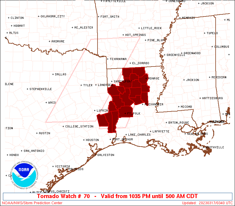
Initial List of Counties in SPC Tornado Watch 70 (WOU)
|
Back to Watch 70
|
 |
   WOUS64 KWNS 170333
   WOU0

   BULLETIN - IMMEDIATE BROADCAST REQUESTED
   TORNADO WATCH OUTLINE UPDATE FOR WT 70
   NWS STORM PREDICTION CENTER NORMAN OK
   1035 PM CDT THU MAR 16 2023

   TORNADO WATCH 70 IS IN EFFECT UNTIL 500 AM CDT FOR THE
    FOLLOWING LOCATIONS

   LAC013-021-027-031-043-049-059-061-069-073-081-085-111-115-127-
   171000-
   /O.NEW.KWNS.TO.A.0070.230317T0335Z-230317T1000Z/

   LA
   .    LOUISIANA PARISHES INCLUDED ARE

   BIENVILLE            CALDWELL            CLAIBORNE
   DE SOTO              GRANT               JACKSON
   LA SALLE             LINCOLN             NATCHITOCHES
   OUACHITA             RED RIVER           SABINE
   UNION                VERNON              WINN


   TXC241-351-403-457-171000-
   /O.NEW.KWNS.TO.A.0070.230317T0335Z-230317T1000Z/

   TX
   .    TEXAS COUNTIES INCLUDED ARE

   JASPER               NEWTON              SABINE
   TYLER


   ATTN...WFO...SHV...LCH...
|
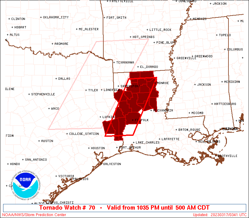
| Aviation Watch (SAW) for WW70 |
|---|
 |
| Note:
The Aviation Watch (SAW) product is an approximation to the watch area.
The actual watch is depicted by the shaded areas. |
   SAW0
   WW 70 TORNADO LA TX 170335Z - 171000Z
   AXIS..40 STATUTE MILES EAST AND WEST OF LINE..
   75NNE IER/NATCHITOCHES LA/ - 60SW POE/FORT POLK LA/
   ..AVIATION COORDS.. 35NM E/W /32SSE ELD - 44WNW LCH/
   HAIL SURFACE AND ALOFT..2 INCHES. WIND GUSTS..60 KNOTS.
   MAX TOPS TO 450. MEAN STORM MOTION VECTOR 28035.

   LAT...LON 32749192 30439322 30439456 32749329

   THIS IS AN APPROXIMATION TO THE WATCH AREA.  FOR A
   COMPLETE DEPICTION OF THE WATCH SEE WOUS64 KWNS
   FOR WOU0.
|
|


 @NWSSPC