 Note:
The expiration time in the watch graphic is amended if the watch is
replaced, cancelled or extended.
Note:
Note:
The expiration time in the watch graphic is amended if the watch is
replaced, cancelled or extended.
Note: Click for
Watch Status Reports.
SEL7
URGENT - IMMEDIATE BROADCAST REQUESTED
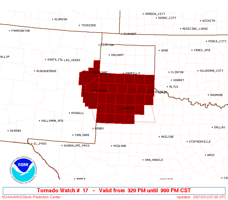
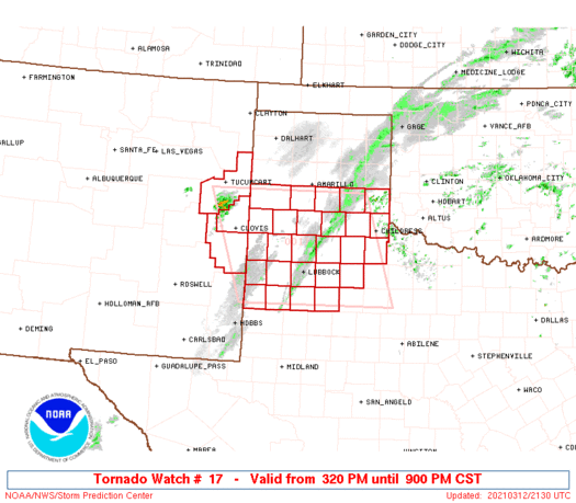
Tornado Watch Number 17
NWS Storm Prediction Center Norman OK
320 PM CST Fri Mar 12 2021
The NWS Storm Prediction Center has issued a
* Tornado Watch for portions of
Far east-central New Mexico
Northwest Texas
* Effective this Friday afternoon and evening from 320 PM until
900 PM CST.
* Primary threats include...
A couple tornadoes possible
Scattered large hail and isolated very large hail events to 2.5
inches in diameter possible
Isolated significant damaging wind gusts to 75 mph possible
SUMMARY...Multiple supercells are expected to develop through this
evening, initially across east-central New Mexico before spreading
into northwest Texas. Scattered large hail, a couple tornadoes, and
isolated severe wind gusts are possible.
The tornado watch area is approximately along and 95 statute miles
east and west of a line from 70 miles north northwest of Plainview
TX to 45 miles south southeast of Lubbock TX. For a complete
depiction of the watch see the associated watch outline update
(WOUS64 KWNS WOU7).
PRECAUTIONARY/PREPAREDNESS ACTIONS...
REMEMBER...A Tornado Watch means conditions are favorable for
tornadoes and severe thunderstorms in and close to the watch
area. Persons in these areas should be on the lookout for
threatening weather conditions and listen for later statements
and possible warnings.
&&
AVIATION...Tornadoes and a few severe thunderstorms with hail
surface and aloft to 2.5 inches. Extreme turbulence and surface wind
gusts to 65 knots. A few cumulonimbi with maximum tops to 450. Mean
storm motion vector 24035.
...Grams
   SEL7

   URGENT - IMMEDIATE BROADCAST REQUESTED
   Tornado Watch Number 17
   NWS Storm Prediction Center Norman OK
   320 PM CST Fri Mar 12 2021

   The NWS Storm Prediction Center has issued a

   * Tornado Watch for portions of
     Far east-central New Mexico
     Northwest Texas

   * Effective this Friday afternoon and evening from 320 PM until
     900 PM CST.

   * Primary threats include...
     A couple tornadoes possible
     Scattered large hail and isolated very large hail events to 2.5
       inches in diameter possible
     Isolated significant damaging wind gusts to 75 mph possible

   SUMMARY...Multiple supercells are expected to develop through this
   evening, initially across east-central New Mexico before spreading
   into northwest Texas. Scattered large hail, a couple tornadoes, and
   isolated severe wind gusts are possible.

   The tornado watch area is approximately along and 95 statute miles
   east and west of a line from 70 miles north northwest of Plainview
   TX to 45 miles south southeast of Lubbock TX. For a complete
   depiction of the watch see the associated watch outline update
   (WOUS64 KWNS WOU7).

   PRECAUTIONARY/PREPAREDNESS ACTIONS...

   REMEMBER...A Tornado Watch means conditions are favorable for
   tornadoes and severe thunderstorms in and close to the watch
   area. Persons in these areas should be on the lookout for
   threatening weather conditions and listen for later statements
   and possible warnings.

   &&

   AVIATION...Tornadoes and a few severe thunderstorms with hail
   surface and aloft to 2.5 inches. Extreme turbulence and surface wind
   gusts to 65 knots. A few cumulonimbi with maximum tops to 450. Mean
   storm motion vector 24035.

   ...Grams
 Note:
The Aviation Watch (SAW) product is an approximation to the watch area.
The actual watch is depicted by the shaded areas.
Note:
The Aviation Watch (SAW) product is an approximation to the watch area.
The actual watch is depicted by the shaded areas.
SAW7
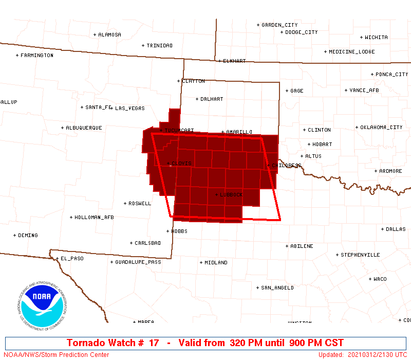
WW 17 TORNADO NM TX 122120Z - 130300Z
AXIS..95 STATUTE MILES EAST AND WEST OF LINE..
70NNW PVW/PLAINVIEW TX/ - 45SSE LBB/LUBBOCK TX/
..AVIATION COORDS.. 85NM E/W /29WSW AMA - 43SSE LBB/
HAIL SURFACE AND ALOFT..2.5 INCHES. WIND GUSTS..65 KNOTS.
MAX TOPS TO 450. MEAN STORM MOTION VECTOR 24035.
LAT...LON 35090051 33069988 33060316 35090387
THIS IS AN APPROXIMATION TO THE WATCH AREA. FOR A
COMPLETE DEPICTION OF THE WATCH SEE WOUS64 KWNS
FOR WOU7.
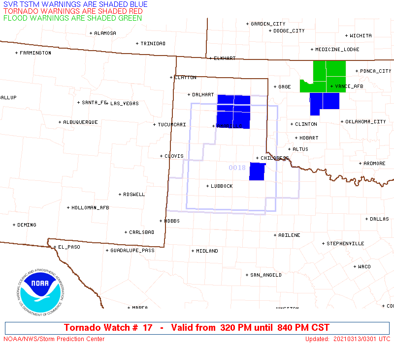
Watch 17 Status Report Message has not been issued yet.
Note:
Click for Complete Product Text.
Tornadoes
Probability of 2 or more tornadoes
|
Mod (40%)
|
Probability of 1 or more strong (EF2-EF5) tornadoes
|
Low (20%)
|
Wind
Probability of 10 or more severe wind events
|
Mod (30%)
|
Probability of 1 or more wind events > 65 knots
|
Mod (30%)
|
Hail
Probability of 10 or more severe hail events
|
Mod (40%)
|
Probability of 1 or more hailstones > 2 inches
|
Mod (40%)
|
Combined Severe Hail/Wind
Probability of 6 or more combined severe hail/wind events
|
High (70%)
|
For each watch, probabilities for particular events inside the watch
(listed above in each table) are determined by the issuing forecaster.
The "Low" category contains probability values ranging from less than 2%
to 20% (EF2-EF5 tornadoes), less than 5% to 20% (all other probabilities),
"Moderate" from 30% to 60%, and "High" from 70% to greater than 95%.
High values are bolded and lighter in color to provide awareness of
an increased threat for a particular event.


 @NWSSPC