Note:
The expiration time in the watch graphic is amended if the watch is
replaced, cancelled or extended.
Note:
Note:
The expiration time in the watch graphic is amended if the watch is
replaced, cancelled or extended.
Note: Click for
Watch Status Reports.
SEL7
URGENT - IMMEDIATE BROADCAST REQUESTED
Severe Thunderstorm Watch Number 297
NWS Storm Prediction Center Norman OK
135 AM CDT Tue Jun 23 2020
The NWS Storm Prediction Center has issued a
* Severe Thunderstorm Watch for portions of
West-central and north-central Texas
* Effective this Tuesday morning from 135 AM until 800 AM CDT.
* Primary threats include...
Scattered damaging winds likely with isolated significant gusts
to 75 mph possible
Isolated large hail events to 1 inch in diameter possible
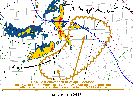
SUMMARY...Progressive QLCS across western north Texas into the Big
Country should spread east-southeast across parts of west-central
and north-central Texas through daybreak. Strong to severe gusts
will be most likely across the western portion of the watch area,
with the overall intensity expected to wane with eastern extent
after sunrise.
The severe thunderstorm watch area is approximately along and 65
statute miles either side of a line from 25 miles northeast of
Dallas TX to 15 miles south southeast of San Angelo TX. For a
complete depiction of the watch see the associated watch outline
update (WOUS64 KWNS WOU7).
PRECAUTIONARY/PREPAREDNESS ACTIONS...
REMEMBER...A Severe Thunderstorm Watch means conditions are
favorable for severe thunderstorms in and close to the watch area.
Persons in these areas should be on the lookout for threatening
weather conditions and listen for later statements and possible
warnings. Severe thunderstorms can and occasionally do produce
tornadoes.
&&
OTHER WATCH INFORMATION...CONTINUE...WW 296...
AVIATION...A few severe thunderstorms with hail surface and aloft to
1 inch. Extreme turbulence and surface wind gusts to 65 knots. A few
cumulonimbi with maximum tops to 550. Mean storm motion vector
29030.
...Grams

   SEL7

   URGENT - IMMEDIATE BROADCAST REQUESTED
   Severe Thunderstorm Watch Number 297
   NWS Storm Prediction Center Norman OK
   135 AM CDT Tue Jun 23 2020

   The NWS Storm Prediction Center has issued a

   * Severe Thunderstorm Watch for portions of
     West-central and north-central Texas

   * Effective this Tuesday morning from 135 AM until 800 AM CDT.

   * Primary threats include...
     Scattered damaging winds likely with isolated significant gusts
       to 75 mph possible
     Isolated large hail events to 1 inch in diameter possible

   SUMMARY...Progressive QLCS across western north Texas into the Big
   Country should spread east-southeast across parts of west-central
   and north-central Texas through daybreak. Strong to severe gusts
   will be most likely across the western portion of the watch area,
   with the overall intensity expected to wane with eastern extent
   after sunrise.

   The severe thunderstorm watch area is approximately along and 65
   statute miles either side of a line from 25 miles northeast of
   Dallas TX to 15 miles south southeast of San Angelo TX. For a
   complete depiction of the watch see the associated watch outline
   update (WOUS64 KWNS WOU7).

   PRECAUTIONARY/PREPAREDNESS ACTIONS...

   REMEMBER...A Severe Thunderstorm Watch means conditions are
   favorable for severe thunderstorms in and close to the watch area.
   Persons in these areas should be on the lookout for threatening
   weather conditions and listen for later statements and possible
   warnings. Severe thunderstorms can and occasionally do produce
   tornadoes.

   &&

   OTHER WATCH INFORMATION...CONTINUE...WW 296...

   AVIATION...A few severe thunderstorms with hail surface and aloft to
   1 inch. Extreme turbulence and surface wind gusts to 65 knots. A few
   cumulonimbi with maximum tops to 550. Mean storm motion vector
   29030.

   ...Grams
 Note:
The Aviation Watch (SAW) product is an approximation to the watch area.
The actual watch is depicted by the shaded areas.
Note:
The Aviation Watch (SAW) product is an approximation to the watch area.
The actual watch is depicted by the shaded areas.
   SAW7
   WW 297 SEVERE TSTM TX 230635Z - 231300Z
   AXIS..65 STATUTE MILES EITHER SIDE OF LINE..
   25NE DAL/DALLAS TX/ - 15SSE SJT/SAN ANGELO TX/
   ..AVIATION COORDS.. 55NM EITHER SIDE /29ENE TTT - 13SSE SJT/
   HAIL SURFACE AND ALOFT..1 INCH. WIND GUSTS..65 KNOTS.
   MAX TOPS TO 550. MEAN STORM MOTION VECTOR 29030.

   LAT...LON 32279604 30339991 32000091 33939706

   THIS IS AN APPROXIMATION TO THE WATCH AREA.  FOR A
   COMPLETE DEPICTION OF THE WATCH SEE WOUS64 KWNS
   FOR WOU7.
Watch 297 Status Report Messages:
STATUS REPORT #3 ON WW 297

VALID 231235Z - 231300Z

THE SEVERE WEATHER THREAT CONTINUES ACROSS THE ENTIRE WATCH AREA.

WW 297 MAY BE ALLOWED TO EXPIRE AT 23/13Z.

..KERR..06/23/20

ATTN...WFO...FWD...SJT...

&&

STATUS REPORT FOR WS 297

SEVERE WEATHER THREAT CONTINUES FOR THE FOLLOWING AREAS

TXC319-231300-

TX
.    TEXAS COUNTIES INCLUDED ARE

MASON
$$


THE WATCH STATUS MESSAGE IS FOR GUIDANCE PURPOSES ONLY.  PLEASE
REFER TO WATCH COUNTY NOTIFICATION STATEMENTS FOR OFFICIAL
INFORMATION ON COUNTIES...INDEPENDENT CITIES AND MARINE ZONES
CLEARED FROM SEVERE THUNDERSTORM AND TORNADO WATCHES.
$$

STATUS REPORT #2 ON WW 297

VALID 231030Z - 231140Z

SEVERE WEATHER THREAT CONTINUES RIGHT OF A LINE FROM 30 SSE SJT
TO 45 NNE JCT TO 35 SSE BWD TO 5 S SEP TO 10 SW MWL TO 40 NNW MWL.

..KERR..06/23/20

ATTN...WFO...FWD...SJT...

&&

STATUS REPORT FOR WS 297

SEVERE WEATHER THREAT CONTINUES FOR THE FOLLOWING AREAS

TXC035-085-097-099-113-121-139-143-181-193-217-221-237-251-281-
307-309-319-327-333-337-367-397-411-425-439-497-231140-

TX
.    TEXAS COUNTIES INCLUDED ARE

BOSQUE		     COLLIN		 COOKE
CORYELL 	     DALLAS		 DENTON
ELLIS		     ERATH		 GRAYSON
HAMILTON	     HILL		 HOOD
JACK		     JOHNSON		 LAMPASAS
MCCULLOCH	     MCLENNAN		 MASON
MENARD		     MILLS		 MONTAGUE
PARKER		     ROCKWALL		 SAN SABA
SOMERVELL	     TARRANT		 WISE
$$


THE WATCH STATUS MESSAGE IS FOR GUIDANCE PURPOSES ONLY.  PLEASE
REFER TO WATCH COUNTY NOTIFICATION STATEMENTS FOR OFFICIAL
INFORMATION ON COUNTIES...INDEPENDENT CITIES AND MARINE ZONES
CLEARED FROM SEVERE THUNDERSTORM AND TORNADO WATCHES.
$$

STATUS REPORT #1 ON WW 297

VALID 230940Z - 231040Z

SEVERE WEATHER THREAT CONTINUES RIGHT OF A LINE FROM 15 SSE SJT
TO 15 NNE BWD TO 40 NW MWL.

..KERR..06/23/20

ATTN...WFO...FWD...SJT...

&&

STATUS REPORT FOR WS 297

SEVERE WEATHER THREAT CONTINUES FOR THE FOLLOWING AREAS

TXC035-049-085-093-095-097-099-113-121-139-143-181-193-217-221-
237-251-281-307-309-319-327-333-337-363-367-397-411-425-439-497-
231040-

TX
.    TEXAS COUNTIES INCLUDED ARE

BOSQUE		     BROWN		 COLLIN
COMANCHE	     CONCHO		 COOKE
CORYELL 	     DALLAS		 DENTON
ELLIS		     ERATH		 GRAYSON
HAMILTON	     HILL		 HOOD
JACK		     JOHNSON		 LAMPASAS
MCCULLOCH	     MCLENNAN		 MASON
MENARD		     MILLS		 MONTAGUE
PALO PINTO	     PARKER		 ROCKWALL
SAN SABA	     SOMERVELL		 TARRANT
WISE
$$


THE WATCH STATUS MESSAGE IS FOR GUIDANCE PURPOSES ONLY.  PLEASE
REFER TO WATCH COUNTY NOTIFICATION STATEMENTS FOR OFFICIAL
INFORMATION ON COUNTIES...INDEPENDENT CITIES AND MARINE ZONES
CLEARED FROM SEVERE THUNDERSTORM AND TORNADO WATCHES.
$$
Note:
Click for Complete Product Text.
Tornadoes
Probability of 2 or more tornadoes
|
Low (<5%)
|
Probability of 1 or more strong (EF2-EF5) tornadoes
|
Low (<2%)
|
Wind
Probability of 10 or more severe wind events
|
Mod (60%)
|
Probability of 1 or more wind events > 65 knots
|
Mod (30%)
|
Hail
Probability of 10 or more severe hail events
|
Low (20%)
|
Probability of 1 or more hailstones > 2 inches
|
Low (10%)
|
Combined Severe Hail/Wind
Probability of 6 or more combined severe hail/wind events
|
High (80%)
|
For each watch, probabilities for particular events inside the watch
(listed above in each table) are determined by the issuing forecaster.
The "Low" category contains probability values ranging from less than 2%
to 20% (EF2-EF5 tornadoes), less than 5% to 20% (all other probabilities),
"Moderate" from 30% to 60%, and "High" from 70% to greater than 95%.
High values are bolded and lighter in color to provide awareness of
an increased threat for a particular event.


 @NWSSPC