Note:
The expiration time in the watch graphic is amended if the watch is
replaced, cancelled or extended.
Note:
Note:
The expiration time in the watch graphic is amended if the watch is
replaced, cancelled or extended.
Note: Click for
Watch Status Reports.
SEL9
URGENT - IMMEDIATE BROADCAST REQUESTED
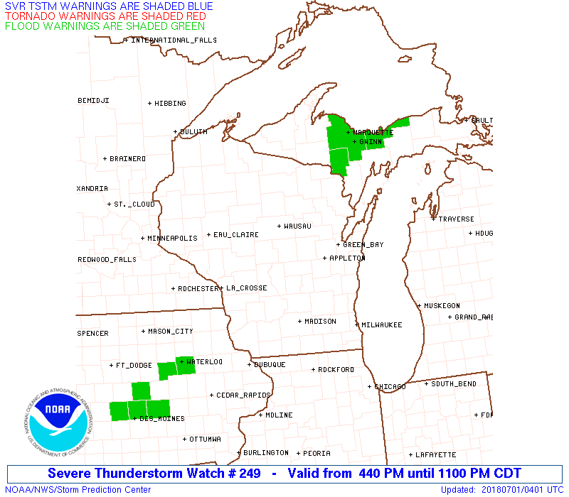
Severe Thunderstorm Watch Number 249
NWS Storm Prediction Center Norman OK
440 PM CDT Sat Jun 30 2018
The NWS Storm Prediction Center has issued a
* Severe Thunderstorm Watch for portions of
Western Upper Michigan
Northeastern into south central Wisconsin
Lake Michigan
Lake Superior
* Effective this Saturday afternoon and evening from 440 PM until
1100 PM CDT.
* Primary threats include...
Scattered large hail and isolated very large hail events to 2
inches in diameter possible
Scattered damaging wind gusts to 70 mph possible
SUMMARY...Bands/clusters of storms are developing from Wisconsin
into western Upper Michigan in a very unstable environment that will
support a mix of organized multicell clusters/bowing segments and
perhaps some embedded supercells. Damaging winds and large hail
will be the main threats through late evening as the storms spread
east-northeastward.
The severe thunderstorm watch area is approximately along and 60
statute miles east and west of a line from 10 miles northwest of
Marquette MI to 50 miles south southwest of Lonerock WI. For a
complete depiction of the watch see the associated watch outline
update (WOUS64 KWNS WOU9).
PRECAUTIONARY/PREPAREDNESS ACTIONS...
REMEMBER...A Severe Thunderstorm Watch means conditions are
favorable for severe thunderstorms in and close to the watch area.
Persons in these areas should be on the lookout for threatening
weather conditions and listen for later statements and possible
warnings. Severe thunderstorms can and occasionally do produce
tornadoes.
&&
OTHER WATCH INFORMATION...CONTINUE...WW 245...WW 246...WW
247...WW 248...
AVIATION...A few severe thunderstorms with hail surface and aloft to
2 inches. Extreme turbulence and surface wind gusts to 60 knots. A
few cumulonimbi with maximum tops to 550. Mean storm motion vector
25030.
...Thompson
 Note:
The Aviation Watch (SAW) product is an approximation to the watch area.
The actual watch is depicted by the shaded areas.
Note:
The Aviation Watch (SAW) product is an approximation to the watch area.
The actual watch is depicted by the shaded areas.
   SAW9
   WW 249 SEVERE TSTM MI WI LM LS 302140Z - 010400Z
   AXIS..60 STATUTE MILES EAST AND WEST OF LINE..
   10NW MQT/MARQUETTE MI/ - 50SSW LNR/LONEROCK WI/
   ..AVIATION COORDS.. 50NM E/W /22NW SAW - 11NE DBQ/
   HAIL SURFACE AND ALOFT..2 INCHES. WIND GUSTS..60 KNOTS.
   MAX TOPS TO 550. MEAN STORM MOTION VECTOR 25030.

   LAT...LON 46638644 42548937 42549173 46638898

   THIS IS AN APPROXIMATION TO THE WATCH AREA.  FOR A
   COMPLETE DEPICTION OF THE WATCH SEE WOUS64 KWNS
   FOR WOU9.
Watch 249 Status Report Messages:
STATUS REPORT #4 ON WW 249

VALID 010220Z - 010340Z

SEVERE WEATHER THREAT CONTINUES RIGHT OF A LINE FROM 35 SSE ESC
TO IMT TO 35 N MQT.

..PICCA..07/01/18

ATTN...WFO...MQT...GRB...MKX...

&&

STATUS REPORT FOR WS 249

SEVERE WEATHER THREAT CONTINUES FOR THE FOLLOWING AREAS

MIC003-041-043-103-109-153-010340-

MI
.    MICHIGAN COUNTIES INCLUDED ARE

ALGER		     DELTA		 DICKINSON
MARQUETTE	     MENOMINEE		 SCHOOLCRAFT
$$


LMZ221-LSZ248-249-250-010340-

CW

.    ADJACENT COASTAL WATERS INCLUDED ARE

GREEN BAY NORTH OF LINE FROM CEDAR RIVER MI TO ROCK ISLAND
PASSAGE

HURON ISLANDS TO MARQUETTE MI

MARQUETTE TO MUNISING MI

MUNISING TO GRAND MARAIS MI

$$
THE WATCH STATUS MESSAGE IS FOR GUIDANCE PURPOSES ONLY.  PLEASE
REFER TO WATCH COUNTY NOTIFICATION STATEMENTS FOR OFFICIAL
INFORMATION ON COUNTIES...INDEPENDENT CITIES AND MARINE ZONES
CLEARED FROM SEVERE THUNDERSTORM AND TORNADO WATCHES.
$$

STATUS REPORT #3 ON WW 249

VALID 010125Z - 010240Z

SEVERE WEATHER THREAT CONTINUES RIGHT OF A LINE FROM 45 ENE ALO
TO 25 ENE LNR TO 35 WSW IMT TO 10 SE IWD.

..PICCA..07/01/18

ATTN...WFO...MQT...GRB...MKX...

&&

STATUS REPORT FOR WS 249

SEVERE WEATHER THREAT CONTINUES FOR THE FOLLOWING AREAS

MIC003-013-041-043-053-061-071-103-109-131-153-010240-

MI
.    MICHIGAN COUNTIES INCLUDED ARE

ALGER		     BARAGA		 DELTA
DICKINSON	     GOGEBIC		 HOUGHTON
IRON		     MARQUETTE		 MENOMINEE
ONTONAGON	     SCHOOLCRAFT
$$


WIC009-015-021-025-037-041-045-047-049-065-075-077-078-083-087-
115-135-137-139-010240-

WI
.    WISCONSIN COUNTIES INCLUDED ARE

BROWN		     CALUMET		 COLUMBIA
DANE		     FLORENCE		 FOREST
GREEN		     GREEN LAKE 	 IOWA
LAFAYETTE	     MARINETTE		 MARQUETTE
MENOMINEE	     OCONTO		 OUTAGAMIE
SHAWANO 	     WAUPACA		 WAUSHARA
WINNEBAGO
$$


LMZ221-521-522-LSZ247-248-249-250-010240-

CW

.    ADJACENT COASTAL WATERS INCLUDED ARE

GREEN BAY NORTH OF LINE FROM CEDAR RIVER MI TO ROCK ISLAND
PASSAGE

GREEN BAY SOUTH OF LINE FROM  CEDAR RIVER TO ROCK ISLAND PASSAGE
AND NORTH OF A LINE FROM OCONTO WI TO LITTLE STURGEON BAY WI

GREEN BAY SOUTH OF LINE FROM  OCONTO WI TO LITTLE STURGEON BAY WI

PORTAGE LAKE TO HURON ISLAND MI TO LOWER ENTRANCE OF PORTAGE
CANAL TO HURON ISLANDS MI INCLUDING KEWEENAW AND HURON BAYS

HURON ISLANDS TO MARQUETTE MI

MARQUETTE TO MUNISING MI

MUNISING TO GRAND MARAIS MI

$$
THE WATCH STATUS MESSAGE IS FOR GUIDANCE PURPOSES ONLY.  PLEASE
REFER TO WATCH COUNTY NOTIFICATION STATEMENTS FOR OFFICIAL
INFORMATION ON COUNTIES...INDEPENDENT CITIES AND MARINE ZONES
CLEARED FROM SEVERE THUNDERSTORM AND TORNADO WATCHES.
$$

STATUS REPORT #2 ON WW 249

VALID 010030Z - 010140Z

THE SEVERE WEATHER THREAT CONTINUES ACROSS THE ENTIRE WATCH AREA.

..PICCA..07/01/18

ATTN...WFO...MQT...GRB...MKX...

&&

STATUS REPORT FOR WS 249

SEVERE WEATHER THREAT CONTINUES FOR THE FOLLOWING AREAS

MIC003-013-041-043-053-061-071-103-109-131-153-010140-

MI
.    MICHIGAN COUNTIES INCLUDED ARE

ALGER		     BARAGA		 DELTA
DICKINSON	     GOGEBIC		 HOUGHTON
IRON		     MARQUETTE		 MENOMINEE
ONTONAGON	     SCHOOLCRAFT
$$


WIC009-015-021-025-037-041-045-047-049-065-067-069-073-075-077-
078-083-085-087-097-111-115-125-135-137-139-141-010140-

WI
.    WISCONSIN COUNTIES INCLUDED ARE

BROWN		     CALUMET		 COLUMBIA
DANE		     FLORENCE		 FOREST
GREEN		     GREEN LAKE 	 IOWA
LAFAYETTE	     LANGLADE		 LINCOLN
MARATHON	     MARINETTE		 MARQUETTE
MENOMINEE	     OCONTO		 ONEIDA
OUTAGAMIE	     PORTAGE		 SAUK
SHAWANO 	     VILAS		 WAUPACA
WAUSHARA	     WINNEBAGO		 WOOD
$$


LMZ221-521-522-LSZ247-248-249-250-010140-

CW

.    ADJACENT COASTAL WATERS INCLUDED ARE

GREEN BAY NORTH OF LINE FROM CEDAR RIVER MI TO ROCK ISLAND
PASSAGE

GREEN BAY SOUTH OF LINE FROM  CEDAR RIVER TO ROCK ISLAND PASSAGE
AND NORTH OF A LINE FROM OCONTO WI TO LITTLE STURGEON BAY WI

GREEN BAY SOUTH OF LINE FROM  OCONTO WI TO LITTLE STURGEON BAY WI

PORTAGE LAKE TO HURON ISLAND MI TO LOWER ENTRANCE OF PORTAGE
CANAL TO HURON ISLANDS MI INCLUDING KEWEENAW AND HURON BAYS

HURON ISLANDS TO MARQUETTE MI

MARQUETTE TO MUNISING MI

MUNISING TO GRAND MARAIS MI

$$
THE WATCH STATUS MESSAGE IS FOR GUIDANCE PURPOSES ONLY.  PLEASE
REFER TO WATCH COUNTY NOTIFICATION STATEMENTS FOR OFFICIAL
INFORMATION ON COUNTIES...INDEPENDENT CITIES AND MARINE ZONES
CLEARED FROM SEVERE THUNDERSTORM AND TORNADO WATCHES.
$$

STATUS REPORT #1 ON WW 249

VALID 302325Z - 010040Z

THE SEVERE WEATHER THREAT CONTINUES ACROSS THE ENTIRE WATCH AREA.

..PICCA..06/30/18

ATTN...WFO...MQT...GRB...MKX...

&&

STATUS REPORT FOR WS 249

SEVERE WEATHER THREAT CONTINUES FOR THE FOLLOWING AREAS

MIC003-013-041-043-053-061-071-103-109-131-153-010040-

MI
.    MICHIGAN COUNTIES INCLUDED ARE

ALGER		     BARAGA		 DELTA
DICKINSON	     GOGEBIC		 HOUGHTON
IRON		     MARQUETTE		 MENOMINEE
ONTONAGON	     SCHOOLCRAFT
$$


WIC009-015-021-025-037-041-045-047-049-065-067-069-073-075-077-
078-083-085-087-097-111-115-125-135-137-139-141-010040-

WI
.    WISCONSIN COUNTIES INCLUDED ARE

BROWN		     CALUMET		 COLUMBIA
DANE		     FLORENCE		 FOREST
GREEN		     GREEN LAKE 	 IOWA
LAFAYETTE	     LANGLADE		 LINCOLN
MARATHON	     MARINETTE		 MARQUETTE
MENOMINEE	     OCONTO		 ONEIDA
OUTAGAMIE	     PORTAGE		 SAUK
SHAWANO 	     VILAS		 WAUPACA
WAUSHARA	     WINNEBAGO		 WOOD
$$


LMZ221-521-522-LSZ247-248-249-250-010040-

CW

.    ADJACENT COASTAL WATERS INCLUDED ARE

GREEN BAY NORTH OF LINE FROM CEDAR RIVER MI TO ROCK ISLAND
PASSAGE

GREEN BAY SOUTH OF LINE FROM  CEDAR RIVER TO ROCK ISLAND PASSAGE
AND NORTH OF A LINE FROM OCONTO WI TO LITTLE STURGEON BAY WI

GREEN BAY SOUTH OF LINE FROM  OCONTO WI TO LITTLE STURGEON BAY WI

PORTAGE LAKE TO HURON ISLAND MI TO LOWER ENTRANCE OF PORTAGE
CANAL TO HURON ISLANDS MI INCLUDING KEWEENAW AND HURON BAYS

HURON ISLANDS TO MARQUETTE MI

MARQUETTE TO MUNISING MI

MUNISING TO GRAND MARAIS MI

$$
THE WATCH STATUS MESSAGE IS FOR GUIDANCE PURPOSES ONLY.  PLEASE
REFER TO WATCH COUNTY NOTIFICATION STATEMENTS FOR OFFICIAL
INFORMATION ON COUNTIES...INDEPENDENT CITIES AND MARINE ZONES
CLEARED FROM SEVERE THUNDERSTORM AND TORNADO WATCHES.
$$
Note:
Click for Complete Product Text.
Tornadoes
Probability of 2 or more tornadoes
|
Low (10%)
|
Probability of 1 or more strong (F2-F5) tornadoes
|
Low (<2%)
|
Wind
Probability of 10 or more severe wind events
|
Mod (40%)
|
Probability of 1 or more wind events > 65 knots
|
Low (20%)
|
Hail
Probability of 10 or more severe hail events
|
Mod (40%)
|
Probability of 1 or more hailstones > 2 inches
|
Mod (30%)
|
Combined Severe Hail/Wind
Probability of 6 or more combined severe hail/wind events
|
High (70%)
|
For each watch, probabilities for particular events inside the watch
(listed above in each table) are determined by the issuing forecaster.
The "Low" category contains probability values ranging from less than 2%
to 20% (F2-F5 tornadoes), less than 5% to 20% (all other probabilities),
"Moderate" from 30% to 60%, and "High" from 70% to greater than 95%.
High values are bolded and lighter in color to provide awareness of
an increased threat for a particular event.


 @NWSSPC