SPC AC 060727
Day 3 Convective Outlook
NWS Storm Prediction Center Norman OK
0227 AM CDT Sat Jul 06 2024
Valid 081200Z - 091200Z
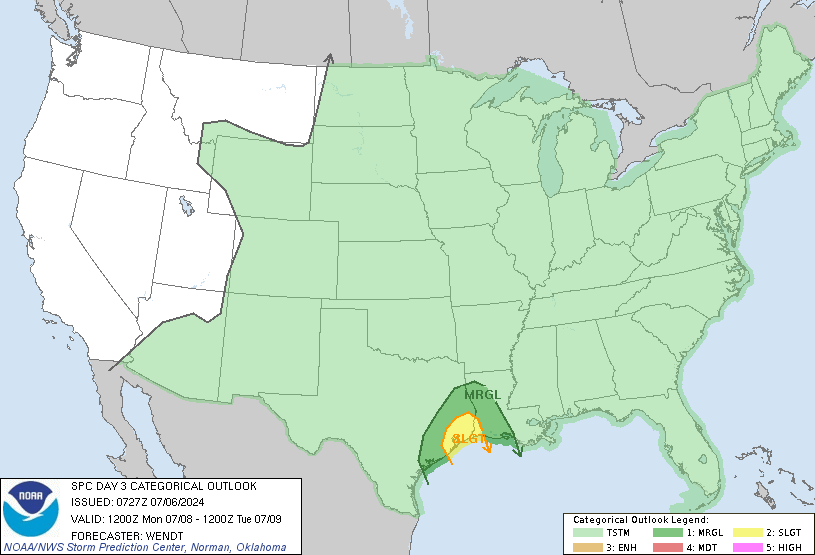
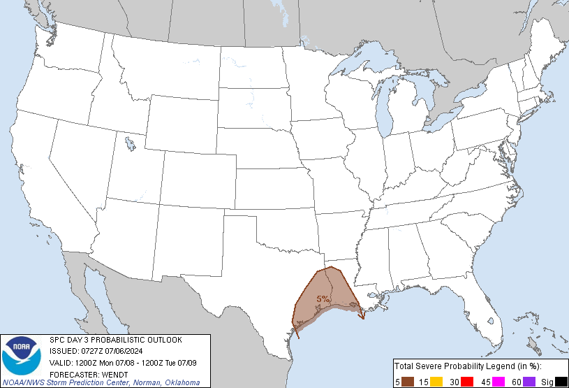
...THERE IS A SLIGHT RISK OF SEVERE THUNDERSTORMS IN SOUTHEAST TEXAS
AND THE ADJACENT SABINE RIVER VALLEY...
...SUMMARY...
A few tornadoes will be possible across parts of southeast Texas
into western Louisiana on Monday.
...Synopsis...
An upper-level trough will progress into the Midwest/Great Lakes
regions on Monday. Some thunderstorm activity is possible ahead of
this trough, but heights will be near neutral or slightly rising
with time and surface features will be quite disorganized. Stronger
storms should remain very isolated. An upper-level ridge along the
West Coast will slowly shift eastward. TC Beryl, currently forecast
by NHC to be transitioning to a tropical depression Monday into
Tuesday, will move through parts of eastern Texas. Strong low-level
winds and rich moisture advection are expected within East Texas
into parts of western Louisiana.
...Parts of East Texas and western Louisiana...
mid to upper 70s F dewpoints will advect onshore as TC Beryl moves
into the Upper Texas Gulf Coast. Strong low-level winds should
extend into parts of western Louisiana with time. Enlarged low-level
hodographs will favor a few rotating storms near the TC circulation
and perhaps along pseudo warm front/theta-e boundary to its east. A
few tornadoes will be possible, particularly in parts of southeast
Texas into the Sabine River vicinity.
..Wendt.. 07/06/2024
CLICK TO GET WUUS03 PTSDY3 PRODUCT
NOTE: THE NEXT DAY 3 OUTLOOK IS SCHEDULED BY 0730Z