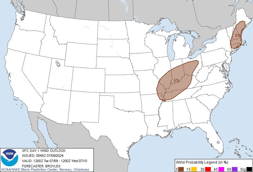
Probability of damaging thunderstorm winds or wind gusts of 50 knots or higher within 25 miles of a point. Hatched Area: 10% of greater probability of wind gusts 65 knots or greater within 25 miles of a point.
SPC AC 090548
Day 1 Convective Outlook
NWS Storm Prediction Center Norman OK
1248 AM CDT Tue Jul 09 2024
Valid 091200Z - 101200Z
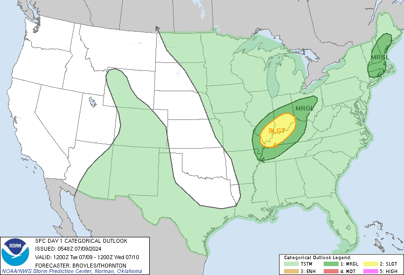
...THERE IS A SLIGHT RISK OF SEVERE THUNDERSTORMS ACROSS PARTS OF
THE LOWER OHIO VALLEY...
...SUMMARY...
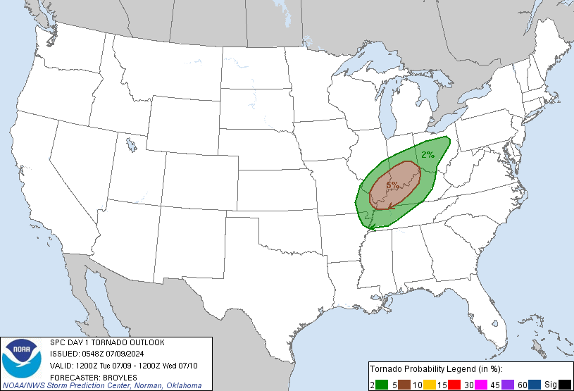
Tornadoes, in association with the remnants of Beryl, will be
possible today from the mid Mississippi Valley northeastward through
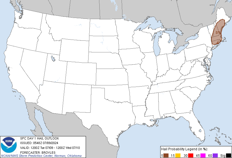
parts of the lower Ohio Valley. Marginally severe wind gusts and
hail will also be possible in parts of New England.
...Lower Ohio Valley/Mid Mississippi Valley...
The remnants of Beryl will move across the mid Mississippi and lower
Ohio Valleys today. Ahead of the associated surface low, surface
dewpoints will be in the lower to mid 70s F. In response to surface
heating, pockets of moderate instability are expected to develop
south of a warm front across parts of Kentucky by afternoon. Model
forecasts are in generally good agreement that a broken line of
storms will develop and move east-northeastward across the lower
Ohio Valley. A 40 to 50 knot low-level speed max is forecast to move
into the lower Ohio Valley during the afternoon. The storms will
likely be located along the northeastern edge of this feature. RAP
forecast soundings during the early to mid afternoon from Paducah to
Louisville generally increase 0-3 km storm-relative helicity into
the 200 to 250 m2/s2 range. This will be favorable for tornadoes
with rotating cells that form in the remnant rainband of Beryl,
especially with storms that interact with a warm front near the Ohio
River. The tornado threat is expected to be greatest in the 18Z to
00Z temporal window. Compared to the previous day, the low-level jet
for today is a bit weaker and further to the west relative to where
the models are forecasting convective development. This introduces
uncertainty concerning the magnitude of today's tornado potential.
...New England...
A low-amplitude trough at mid-levels will move eastward across
Quebec and New England today. Ahead of the trough, a moist and
unstable airmass will be in place by afternoon from the Mid-Atlantic
northeastward into New England. As surface temperatures warm,
scattered thunderstorms are expected to develop in the higher
terrain of New England early this afternoon. Some of this convection
will move eastward into the lower elevations by late afternoon. RAP
forecast soundings near the instability axis from southern Vermont
into southern New Hampshire have MLCAPE peaking in the 1000 to 1500
J/kg range, with 0-3 km lapse rates approaching 8 C/km. This,
combined with moderate deep-layer shear will be enough for an
isolated wind-damage threat. A few rotating storms with hail
potential will also be possible.
..Broyles/Thornton.. 07/09/2024
CLICK TO GET WUUS01 PTSDY1 PRODUCT
NOTE: THE NEXT DAY 1 OUTLOOK IS SCHEDULED BY 1300Z