Probability of a tornado within 25 miles of a point. Hatched Area: 10% or greater probability of EF2 - EF5 tornadoes within 25 miles of a point.
Day 1 Tornado Risk
Area (sq. mi.)
Area Pop.
Some Larger Population Centers in Risk Area
No Risk Areas Forecast
Probabilistic Damaging Wind Graphic
Probability of damaging thunderstorm winds or wind gusts of 50 knots or higher within 25 miles of a point. Hatched Area: 10% of greater probability of wind gusts 65 knots or greater within 25 miles of a point.
Day 1 Wind Risk
Area (sq. mi.)
Area Pop.
Some Larger Population Centers in Risk Area
No Risk Areas Forecast
Probabilistic Large Hail Graphic
Probability of hail 1" or larger within 25 miles of a point. Hatched Area: 10% or greater probability of hail 2" or larger within 25 miles of a point.
Day 1 Hail Risk
Area (sq. mi.)
Area Pop.
Some Larger Population Centers in Risk Area
No Risk Areas Forecast
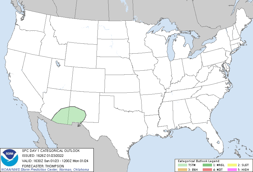
   SPC AC 231626

   Day 1 Convective Outlook
   NWS Storm Prediction Center Norman OK
   1026 AM CST Sun Jan 23 2022

   Valid 231630Z - 241200Z

   ...NO SEVERE THUNDERSTORM AREAS FORECAST...

   ...SUMMARY...
   Isolated weak thunderstorms are possible across southeast Arizona
   and southwest New Mexico today.

   ...AZ/NM/TX through tonight...
   A closed midlevel low will move slowly eastward from Sonora/southern
   AZ to far west TX by Monday morning.  Cold midlevel temperatures
   with association steep lapse rates and weak buoyancy will support
   the potential for isolated thunderstorms, aided this afternoon by
   surface heating/mixing.  Some elevated convection (rooted near 700
   mb) may occur farther east in TX overnight, in the zone of ascent
   preceding the midlevel trough.  However, buoyancy will be limited,
   and it is not clear that cloud depth will be sufficient for
   lightning production.

   ..Thompson.. 01/23/2022

   CLICK TO GET WUUS01 PTSDY1 PRODUCT

   NOTE: THE NEXT DAY 1 OUTLOOK IS SCHEDULED BY 2000Z