SPC AC 260834
Day 3 Convective Outlook CORR 1
NWS Storm Prediction Center Norman OK
0234 AM CST Sun Feb 26 2017
Valid 281200Z - 011200Z
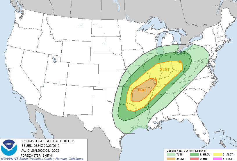
...THERE IS AN ENHANCED RISK OF SEVERE THUNDERSTORMS OVER THE OZARK
PLATEAU INTO SOUTHEASTERN MISSOURI...
...THERE IS A SLIGHT RISK OF SEVERE THUNDERSTORMS FROM NORTHEAST
TEXAS NORTHEASTWARD INTO THE MIDDLE MISSISSIPPI VALLEY AND OHIO
VALLEY...
...THERE IS A MARGINAL RISK OF SEVERE THUNDERSTORMS SURROUNDING THE
SLIGHT RISK...
CORRECTED FOR THE MENTION OF POSSIBLE SEVERE IN THE OHIO VALLEY IN
THE SUMMARY SECTION
...SUMMARY...
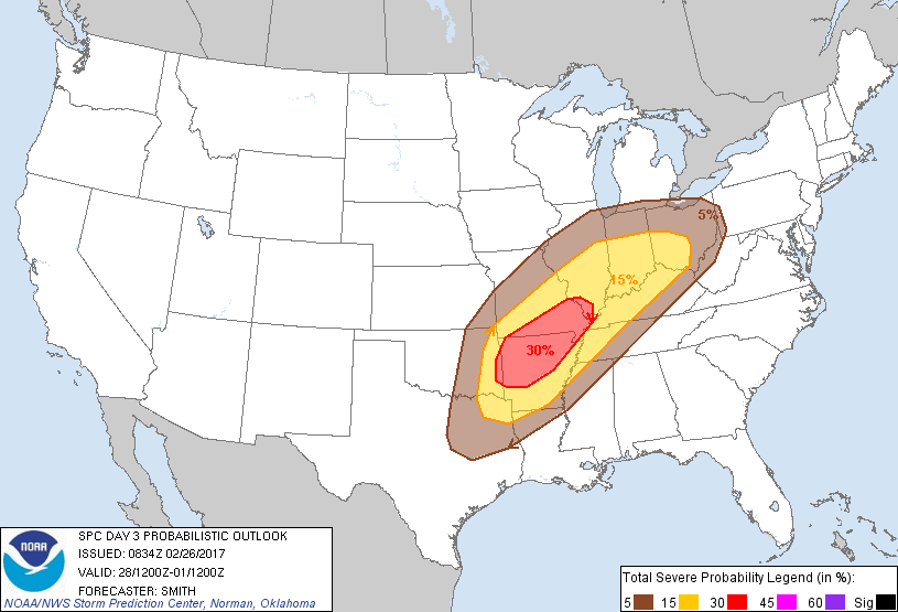
Severe thunderstorms will be possible on Tuesday and Tuesday night
from eastern portions of Oklahoma and Texas eastward into parts of
the lower and middle Mississippi Valley and Ohio Valley.
...Synopsis...
A large-scale mid-level trough over the western U.S. will move into
the central states on Tuesday as a belt of strong southwesterly
500-mb flow intensifies further during the period as a 100-kt speed
max moves to the lower MO Valley by early Wednesday morning. In the
low levels, a broad warm sector will become established from the
central Gulf Coast states northward into the OH Valley and bounded
on the north with an advancing warm front. The west edge of the
low-level moisture will likely be located over the eastern portions
of TX/OK as an elongated area of low pressure extends from the
middle MS Valley/Great Lakes southwestward into OK/KS and developing
eastward into the Ozarks during the overnight.
...eastern OK/northeast TX northeastward into the MS Valley and
lower OH Valley...
Complicated forecast scenario with significant uncertainty is
evident in both the coverage and intensity of severe thunderstorms
across a large warm/moist sector. Steep 700-500 mb lapse rates (7-8
degrees C per km) atop lower to middle 60s dewpoints over AR and
dewpoints near 60 degrees F in the OH Valley will contribute to weak
to moderate buoyancy. Strong shear profiles (60-70 kt effective
shear) will result in a supercell-wind profile. A wide array of
possibilities are plausible at this time, including a risk for
warm-air-advection storms developing during the late
afternoon/evening over portions of AR and the MS Valley and yielding
a tornado and hail risk. Complicating this scenario includes a
cirrus canopy implied by model data as well as the degree of
heating.
A cold front is forecast to move into the western portions of the
broad outlook area during the evening and overnight and push
east-southeastward. Thunderstorms are likely to develop along the
front and severe is possible with this activity as well. Damaging
winds and hail will be the predominate risks early on with this
activity before upscale growth into one or more larger convective
lines and bowing segments yields a continued wind risk and perhaps a
lingering tornado threat.
..Smith.. 02/26/2017
CLICK TO GET WUUS03 PTSDY3 PRODUCT
NOTE: THE NEXT DAY 3 OUTLOOK IS SCHEDULED BY 0830Z