|
| Mesoscale Discussion 1559 |
|
< Previous MD Next MD >
|
|
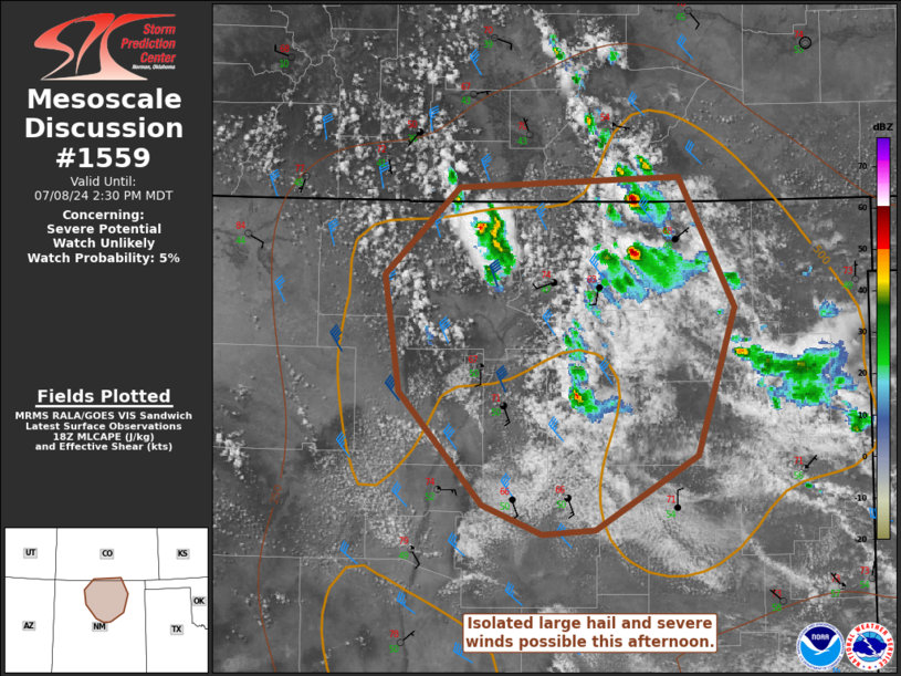
   Mesoscale Discussion 1559
   NWS Storm Prediction Center Norman OK
   0133 PM CDT Mon Jul 08 2024

   Areas affected...North-central New Mexico

   Concerning...Severe potential...Watch unlikely

   Valid 081833Z - 082030Z

   Probability of Watch Issuance...5 percent

   SUMMARY...Isolated, marginally severe hail and strong/severe wind
   gusts are possible as storms develop and move southeastward. A watch
   is not likely.

   DISCUSSION...Surface dewpoints have help in the upper 40s to low 50s
   F in north-central New Mexico. With very modest mid-level ascent
   along the base of the departing upper-level trough, a few storms
   have deepened early this afternoon within the terrain. Effective
   shear of 30-35 kts will promote some storm organization. Much of the
   shear is concentrated in the lowest 6 km with fairly minimal shear
   above that level. Despite steep mid-level lapse rates, hail size
   should be tempered by this less favorable wind profile. Steep
   low-level lapse rates will support isolated strong/severe wind gusts
   as well. Cloud cover and drier air moving into the northeastern
   plains will likely limit how far southeast this activity will
   progress this afternoon.

   ..Wendt/Guyer.. 07/08/2024

   ...Please see www.spc.noaa.gov for graphic product...

   ATTN...WFO...PUB...ABQ...GJT...

   LAT...LON   36490707 37090644 37160462 36280416 35270446 34780531
               34750575 34950626 35710695 36490707
|
|
Top/All Mesoscale Discussions/Forecast Products/Home
|
|


 @NWSSPC