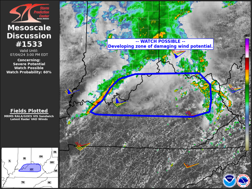
   Mesoscale Discussion 1533
   NWS Storm Prediction Center Norman OK
   1130 AM CDT Thu Jul 04 2024

   Areas affected...northern Kentucky...far southern Indiana

   Concerning...Severe potential...Watch possible

   Valid 041630Z - 041900Z

   Probability of Watch Issuance...60 percent

   SUMMARY...A corridor of scattered damaging gusts or marginal hail
   potential exists over much of central and northern Kentucky and
   toward the Ohio River.

   DISCUSSION...Within a weak surface trough and on the southern
   periphery of the earlier rain/outflow, an extremely moist air mass
   continues to heat and destabilize. Mid 70s F dewpoints exist along
   with GPW PWAT values over 2.25". Meanwhile, strong heating exists
   south of the outflow/frontal zone, with warming into the lower 90s
   F.

   Primarily westerly flow exists across the area, except
   west/southwest within the boundary layer. As such, little northward
   movement in the existing surface theta-e gradient is anticipated
   over the next few hours.

   VWPs indicate 35+ kt speeds at 700 mb, with around 50 kt at 500 mb.
   As a result, developing robust storms now over southern IN and
   western KY are likely to intensify and perhaps expand a bit in N/S
   coverage through the afternoon. Ample PWAT to support downbursts,
   steepening low-level lapse rates, and favorable low to midlevel mean
   wind speeds all support a developing damaging wind threat, and a
   watch may be needed.

   ..Jewell/Gleason.. 07/04/2024

   ...Please see www.spc.noaa.gov for graphic product...

   ATTN...WFO...RLX...JKL...ILN...LMK...PAH...

   LAT...LON   37518361 37558684 37578711 37638730 37978688 38348659
               38598628 38748569 38768439 38778332 38438292 37988290
               37648298 37518361
|


 @NWSSPC