|
| Mesoscale Discussion 1233 |
|
< Previous MD Next MD >
|
|
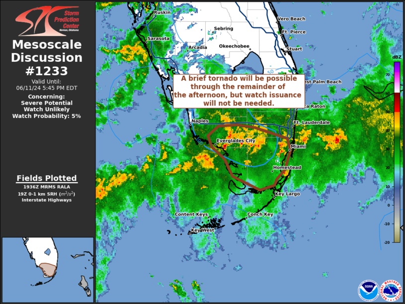
   Mesoscale Discussion 1233
   NWS Storm Prediction Center Norman OK
   0238 PM CDT Tue Jun 11 2024

   Areas affected...far south Florida

   Concerning...Severe potential...Watch unlikely

   Valid 111938Z - 112145Z

   Probability of Watch Issuance...5 percent

   SUMMARY...A brief tornado will be possible through the late
   afternoon hours across the Everglades. Watch issuance will not be
   needed.

   DISCUSSION...Convective cells embedded with a broad stratiform rain
   shield across the FL Everglades have taken on supercellular
   characteristics over the past few hours per reflectivity/velocity
   imagery from KAMX. Broad/weak, transient mesocyclones have been
   observed mainly south of the I-75 corridor before weakening as they
   migrate into a well-established cold pool north of the interstate.
   Despite the expansive precipitation shield across the region, ample
   low-level moisture (dewpoints in the mid/upper 70s) is supporting
   around 1500 J/kg MLCAPE, which will remain sufficient to support a
   few deeper convective towers. Additionally, regional VWPs continue
   to show around 50-100 m2/s2 0-1 SRH with a slight increase in 1 km
   winds up to 30-35 knots noted over the past hour or so. While not
   substantial, this low-level shear has been sufficient to support
   some degree of low-level rotation, which may result in a brief
   tornado within the Everglades region through late afternoon.

   ..Moore/Smith.. 06/11/2024

   ...Please see www.spc.noaa.gov for graphic product...

   ATTN...WFO...MFL...

   LAT...LON   25198067 25398110 25638124 25818144 25988151 26118134
               26138104 26098075 25938022 25778018 25498026 25348040
               25258044 25198067
|
|
Top/All Mesoscale Discussions/Forecast Products/Home
|
|


 @NWSSPC