|
| Mesoscale Discussion 1189 |
|
< Previous MD Next MD >
|
|
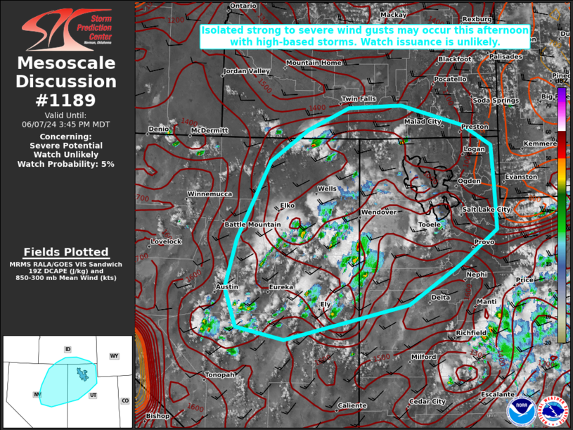
   Mesoscale Discussion 1189
   NWS Storm Prediction Center Norman OK
   0222 PM CDT Fri Jun 07 2024

   Areas affected...Portions of northern NV/UT into southern ID

   Concerning...Severe potential...Watch unlikely

   Valid 071922Z - 072145Z

   Probability of Watch Issuance...5 percent

   SUMMARY...Isolated strong to severe wind gusts may occur this
   afternoon with high-based thunderstorms. Watch issuance is unlikely.

   DISCUSSION...Thunderstorms have developed this afternoon across
   parts of northeast NV into western UT, as a shortwave trough
   continues to move eastward across CA/NV. Robust daytime heating has
   allowed surface temperatures to generally increase into the 80s.
   Amid steepening low/mid-level lapse rates, a well-mixed boundary
   layer should encourage some enhancement to convective downdraft
   winds as DCAPE increases into the 1000-1500 J/kg range. Isolated
   strong to severe wind gusts around 50-70 mph may occur with any of
   the more robust cores that can develop and be sustained this
   afternoon and early evening. Occasional marginally severe hail also
   appears possible, with around 30-35 kt of deep-layer shear
   supporting modest updraft organization. Limited instability and
   low-level moisture, with MLCAPE generally forecast to remain less
   than 1000 J/kg, should tend to temper the overall severe threat.
   Accordingly, watch issuance is not anticipated.

   ..Gleason/Guyer.. 06/07/2024

   ...Please see www.spc.noaa.gov for graphic product...

   ATTN...WFO...SLC...PIH...BOI...LKN...

   LAT...LON   39561686 40361663 41621594 42121514 42491426 42531313
               42201182 41871122 41241117 40501113 39961188 39311299
               38741560 38941661 39561686
|
|
Top/All Mesoscale Discussions/Forecast Products/Home
|
|


 @NWSSPC