|
| Mesoscale Discussion 1315 |
|
< Previous MD Next MD >
|
|
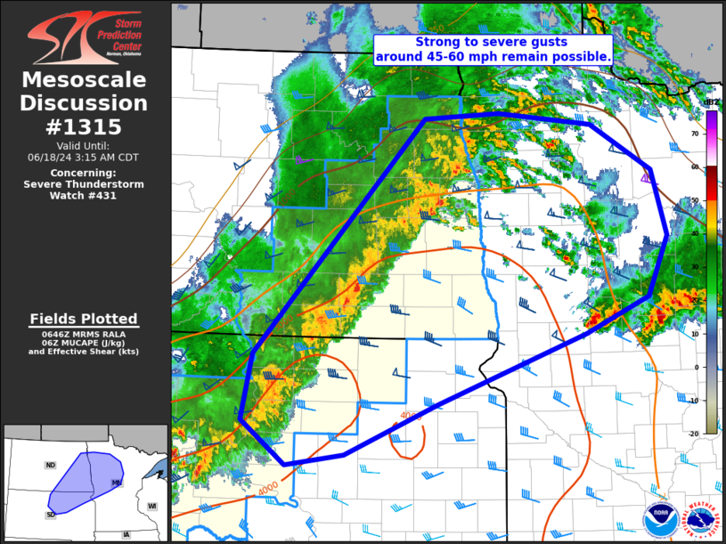
   Mesoscale Discussion 1315
   NWS Storm Prediction Center Norman OK
   0149 AM CDT Tue Jun 18 2024

   Areas affected...northeast SD...eastern ND...and northwest MN

   Concerning...Severe Thunderstorm Watch 431...

   Valid 180649Z - 180815Z

   The severe weather threat for Severe Thunderstorm Watch 431
   continues.

   SUMMARY...Strong to severe thunderstorm gusts around 45-60 mph
   remain possible across Severe Thunderstorm Watch 431.

   DISCUSSION...A semi-organized line of convection will continue to
   shift east across eastern ND and northeast SD the next few hours.
   Mostly sub-severe gusts in the 40-50 mph range have be noted in
   surface observations. However, JMS recently gusted to 60 mph. Expect
   this general trend to continue across the watch area for another 1-2
   hours. Trends are being monitored for possible downstream watch into
   parts of MN.

   ..Leitman.. 06/18/2024

   ...Please see www.spc.noaa.gov for graphic product...

   ATTN...WFO...DLH...MPX...FGF...ABR...BIS...

   LAT...LON   48309770 48369654 48229508 47739412 47029390 46379420
               45979518 45229749 44669892 44559981 45020050 45750035
               48309770
|
|
Top/All Mesoscale Discussions/Forecast Products/Home
|
|


 @NWSSPC