|
| Mesoscale Discussion 1294 |
|
< Previous MD Next MD >
|
|
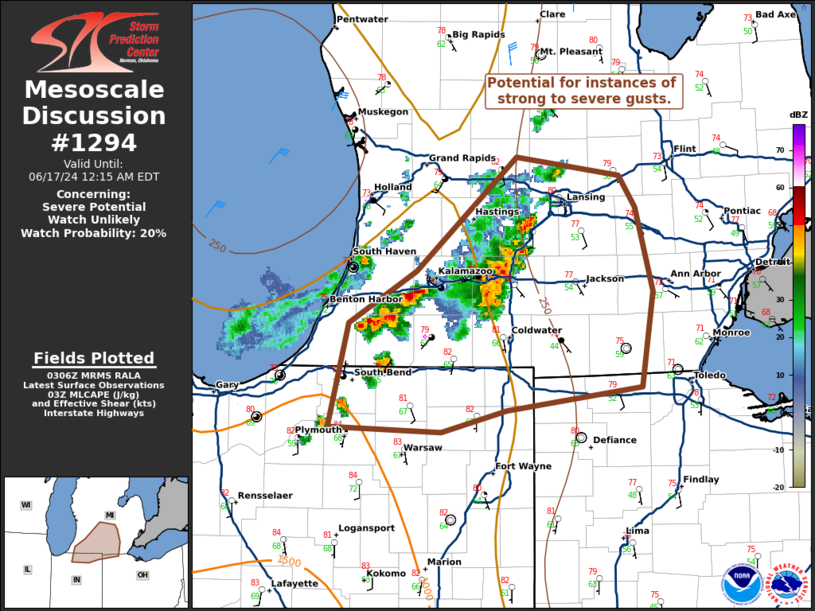
   Mesoscale Discussion 1294
   NWS Storm Prediction Center Norman OK
   1008 PM CDT Sun Jun 16 2024

   Areas affected...south-central Michigan into far northern Indiana
   and Ohio

   Concerning...Severe potential...Watch unlikely

   Valid 170308Z - 170415Z

   Probability of Watch Issuance...20 percent

   SUMMARY...A line of thunderstorms will be capable of producing
   instances of strong to severe winds over the next 1-2 hours.

   DISCUSSION...A line of thunderstorms moving eastward across the far
   south-central Michigan have a history of producing damaging wind and
   a measured gust up to 76 mph near Kalamazoo, MI. This line of
   thunderstorms is moving into a drier and more stable airmass to the
   east, where dew points are in the mid to upper 50s with MLCAPE
   decreasing to <500 J/kg. As such, this line is expected to weaken in
   the next 1-2 hours, limiting the severe threat with eastward extent.
   New convection has developed to the south and west of this line,
   which also may pose a risk for occasional strong to severe wind
   before moving into the more stable air to the east.

   ..Thornton/Smith.. 06/17/2024

   ...Please see www.spc.noaa.gov for graphic product...

   ATTN...WFO...DTX...IWX...GRR...

   LAT...LON   41378553 41408644 42028627 42338574 43008494 42908411
               42718398 42208384 41648394 41508501 41378553
|
|
Top/All Mesoscale Discussions/Forecast Products/Home
|
|


 @NWSSPC