|
| Mesoscale Discussion 952 |
|
< Previous MD Next MD >
|
|
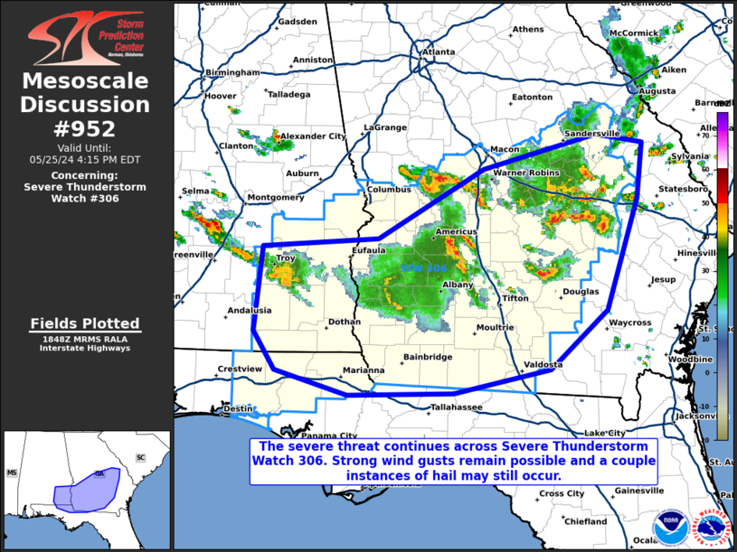
   Mesoscale Discussion 0952
   NWS Storm Prediction Center Norman OK
   0150 PM CDT Sat May 25 2024

   Areas affected...portions of southeast Alabama into central and
   southern Georgia

   Concerning...Severe Thunderstorm Watch 306...

   Valid 251850Z - 252015Z

   The severe weather threat for Severe Thunderstorm Watch 306
   continues.

   SUMMARY...The severe threat continues across Severe Thunderstorm
   Watch 306. Damaging gusts are the main threat, though a couple
   instances of hail may also occur with the stronger storms.

   DISCUSSION...Multicell clusters have percolated in intensity across
   southeast AL into central and southern GA over the past few hours.
   The ambient environment remains unstable ahead of the ongoing
   storms, as peak diurnal heating is underway. Damaging gusts remain a
   possibility wherever thunderstorm cold-pool merging can occur. Some
   hail may also be found in some of the deepest, strongest storm
   cores. Storms should continue with at least an isolated severe
   threat until convective overturning has diminished buoyancy over
   most of the area.

   ..Squitieri.. 05/25/2024

   ...Please see www.spc.noaa.gov for graphic product...

   ATTN...WFO...CHS...CAE...JAX...FFC...TAE...BMX...

   LAT...LON   31988608 32068483 32718367 33038244 32958194 32428200
               31388234 30848295 30618401 30598515 30838594 31198618
               31988608
|
|
Top/All Mesoscale Discussions/Forecast Products/Home
|
|


 @NWSSPC