|
| Mesoscale Discussion 911 |
|
< Previous MD Next MD >
|
|
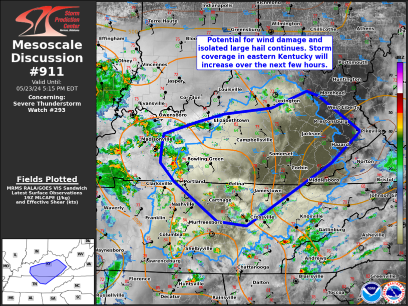
   Mesoscale Discussion 0911
   NWS Storm Prediction Center Norman OK
   0216 PM CDT Thu May 23 2024

   Areas affected...Portions of Middle/Eastern Tennessee into
   central/eastern Kentucky

   Concerning...Severe Thunderstorm Watch 293...

   Valid 231916Z - 232115Z

   The severe weather threat for Severe Thunderstorm Watch 293
   continues.

   SUMMARY...Wind damage and isolated large hail remains possible this
   afternoon. Storm coverage should increase into more central/eastern
   Kentucky over the next few hours.

   DISCUSSION...Storms continue to develop ahead of a weak MCV in the
   Mid-South. Destabilization continues into eastern Kentucky where
   temperatures have risen to near 80 F. A cluster of storms west of
   Bowling Green will pose a more organized threat of wind damage,
   particularly as buoyancy increases ahead of this activity. Isolated
   large hail is possible in the most intense, discrete storms.

   ..Wendt.. 05/23/2024

   ...Please see www.spc.noaa.gov for graphic product...

   ATTN...WFO...MRX...JKL...LMK...OHX...PAH...

   LAT...LON   35938574 36638671 36988702 37298700 37498695 37718621
               37878560 37988452 38278370 38188343 37538249 36978318
               35848507 35938574
|
|
Top/All Mesoscale Discussions/Forecast Products/Home
|
|


 @NWSSPC