|
| Mesoscale Discussion 195 |
|
< Previous MD Next MD >
|
|
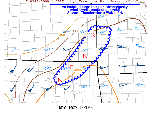
   Mesoscale Discussion 0195
   NWS Storm Prediction Center Norman OK
   0518 AM CDT Wed Mar 17 2021

   Areas affected...Portions of northeastern OK...southeastern KS...and
   southwestern/west-central MO

   Concerning...Severe Thunderstorm Watch 24...

   Valid 171018Z - 171145Z

   The severe weather threat for Severe Thunderstorm Watch 24
   continues.

   SUMMARY...An isolated large hail and strong/gusty wind threat
   continues across Severe Thunderstorm Watch 24.

   DISCUSSION...A messy, cluster storm mode has developed across
   northeastern OK into southeastern KS and southwestern/west-central
   MO. This convection will likely remain elevated this morning to the
   north of a surface boundary. Although storm mode is not overly
   favorable, occasional marginally severe hail will remain possible
   along an elevated instability gradient (MUCAPE 1000-2000 J/kg).
   Isolated strong/gusty winds may also occur as individual cells
   develop northeastward. Recently, additional convection has begun to
   develop farther south into northeastern OK along a low-level warm
   advection wing and where surface dewpoints are slightly higher
   (generally mid to upper 50s). It remains to be seen whether storms
   will be able to strengthen south of the ongoing band. If they do,
   then all severe hazards, including a brief tornado, would be
   possible.

   ..Gleason.. 03/17/2021

   ...Please see www.spc.noaa.gov for graphic product...

   ATTN...WFO...SGF...EAX...TSA...ICT...

   LAT...LON   36129643 36329670 37269575 38349479 38279395 37779407
               37199459 36449551 36129643
|
|
Top/All Mesoscale Discussions/Forecast Products/Home
|
|


 @NWSSPC