|
| Mesoscale Discussion 1402 |
|
< Previous MD Next MD >
|
|
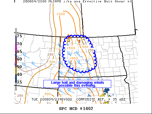
   Mesoscale Discussion 1402
   NWS Storm Prediction Center Norman OK
   0718 PM CDT Tue Aug 04 2020

   Areas affected...Portions of western and central North Dakota

   Concerning...Severe potential...Watch unlikely

   Valid 050018Z - 050215Z

   Probability of Watch Issuance...20 percent

   SUMMARY...A few storms will be capable of large hail this evening as
   well as damaging wind gusts. Some upscale growth and organization
   along an effective boundary in central North Dakota is possible,
   which would mean a marginally increased wind gust threat. Limited
   MLCAPE and and organizing low-level jet decrease confidence in the
   need for a WW.

   DISCUSSION...A mid-level shortwave continues to approach
   northwestern North Dakota this evening. Convection has begun to move
   in from Canada with further development occurring along the cold
   front and along an effective warm front to the east. Modifying the
   00Z observed BIS sounding suggests 500-1000 J/kg MLCAPE ahead of
   this activity with around 30 kts of effective shear. With a
   mid-level lapse rate near 7 C/km, some large hail is possible with
   more intense/discrete storms. Given the upper-level forcing, this
   activity will likely last into the evening, perhaps 9-10 CDT, until
   encountering more stable conditions to the east. If storms can
   cluster and grow upscale, a small linear segment may progress
   southeast along the effective boundary, marginally increasing the
   wind gusts threat. Lack of a more buoyant airmass and a
   weak/negligible low-level jet this evening lend to uncertainty with
   how far southeast and how severe the activity will be. At present,
   no WW is anticipated.

   ..Wendt/Hart.. 08/05/2020

   ...Please see www.spc.noaa.gov for graphic product...

   ATTN...WFO...BIS...

   LAT...LON   48670340 49030316 49040136 48820078 47900014 46769998
               46410097 46420181 46900309 47550353 48670340
|
|
Top/All Mesoscale Discussions/Forecast Products/Home
|
|


 @NWSSPC