Mesoscale Discussion 0710
NWS Storm Prediction Center Norman OK
0550 PM CDT Mon May 20 2019
Areas affected...Southeast Texas Panhandle...Eastern Texas South
Plains...Portions of Permian Basin
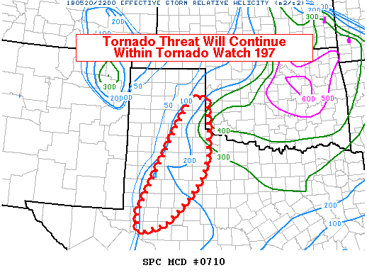
Concerning...Tornado Watch 197...
Valid 202250Z - 210045Z
The severe weather threat for Tornado Watch 197 continues.
SUMMARY...The tornado threat will continue within WW 197. Given the
strength of the low-level shear expected, tornadoes will be possible
with all storm modes. However, significant tornadoes will remain
possible with any storm that can remain discrete.
DISCUSSION...Several discrete/semi-discrete supercell thunderstorms
are ongoing across WW 197. So far, tornadic activity has been
limited by the number of storms ongoing in relative close proximity.
Nevertheless, very strong deep-layer shear (60-70 kts) and strong
low-level veering ahead of these storms, particularly in northwest
Texas and into southwest Oklahoma, will continue to support strong
low-level rotation. As the low-level jet continues to increase this
evening, the tornado threat should also increase. The threat for
strong tornadoes will generally be modulated by storm mode. Any
storm that can remain discrete will continue to pose a threat for a
significant tornado. However, given the very strong low-level shear,
tornadoes will remain possible within linear segments.
..Wendt.. 05/20/2019
...Please see www.spc.noaa.gov for graphic product...
ATTN...WFO...OUN...SJT...LUB...AMA...MAF...
LAT...LON 34630113 35500060 35590001 34619991 33759995 33110014
32410063 31570148 31310245 31880254 34630113
|


 @NWSSPC