|
| Mesoscale Discussion 499 |
|
< Previous MD Next MD >
|
|
MESOSCALE DISCUSSION 0499
NWS STORM PREDICTION CENTER NORMAN OK
0940 PM CDT FRI MAY 07 2010
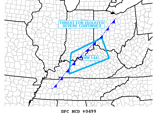
AREAS AFFECTED...SERN IN...NRN KY...SWRN OH
CONCERNING...SEVERE THUNDERSTORM WATCH 144...
VALID 080240Z - 080415Z
THE SEVERE WEATHER THREAT FOR SEVERE THUNDERSTORM WATCH 144
CONTINUES.
RADAR TRENDS REVEAL STORMS HAVE BEEN RATHER DISORGANIZED ACROSS THE
WATCH AREA...LIKELY DUE TO CAPPING ISSUES AWAY FROM THE FRONT.
STILL...COOLING ALOFT/HEIGHT FALLS WITH THE UPPER TROUGH...AS WELL
AS FORCING ALONG THE COLD FRONT WITH STRONG PRESSURE RISES
BEHIND...SUGGEST A THREAT OF ADDITIONAL DEVELOPMENT ACROSS THE WATCH
AREA.
..JEWELL.. 05/08/2010
ATTN...WFO...JKL...ILN...LMK...IND...PAH...
LAT...LON 38108340 36958712 38518696 39618404 38108340
|
|
Top/All Mesoscale Discussions/Forecast Products/Home
|
|


 @NWSSPC