Mesoscale Discussion 0422
NWS Storm Prediction Center Norman OK
1254 PM CDT Thu Apr 11 2024
Areas affected...portions of northeast Tennessee and eastern
Kentucky into extreme western Virginia and western West Virginia
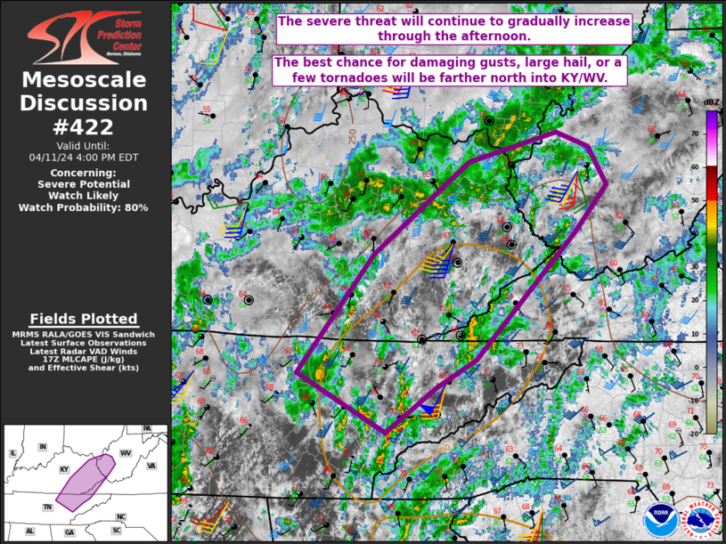
Concerning...Severe potential...Watch likely
Valid 111754Z - 112000Z
Probability of Watch Issuance...80 percent
SUMMARY...The severe threat should gradually increase into the
afternoon and with northern extent. The stronger, longer-lasting
storms will be capable of large hail and damaging gusts, with a
tornado or two possible farther north into KY/WV where low-level
shear is stronger.
DISCUSSION...Pockets of surface heating, amid widespread clouds and
ongoing showers and thunderstorms, is supporting surface
temperatures rising into the mid 60s to 70 F amid upper 50s to low
60s F dewpoints. The surface heating is allowing for the steepening
of low-level lapse rates, boosting MLCAPE to over 500 J/kg in spots.
Meanwhile, the approach of a longer-wave mid-level trough is
promoting continued deep-layer ascent across the region, that in
tandem with deep-layer shear, should only increase with time. As
such, the increasing intensity and coverage of storms will be
gradual this afternoon, and will be dependent on continued
destabilization over eastern portions of the OH Valley.
Initial storms may produce gusty winds and hail across northeast TN
into eastern KY. However, as storms potentially intensify into the
afternoon hours, damaging gusts will become a greater concern as
storms move into northeast KY into WV. Given larger, curved
low-level hodographs driven by backed flow, the best chance for any
tornado development will also be in the northeast KY/WV area later
this afternoon. As such, overall greater WW issuance possibilities
increase with northward extent this afternoon.
..Squitieri/Guyer.. 04/11/2024
...Please see www.spc.noaa.gov for graphic product...
ATTN...WFO...RLX...MRX...JKL...LMK...OHX...
LAT...LON 36258528 37468432 38408310 38718199 38558157 38178134
37688177 36888256 36408301 36128352 35668416 36258528
|


 @NWSSPC