|
| Mesoscale Discussion 635 |
|
< Previous MD Next MD >
|
|
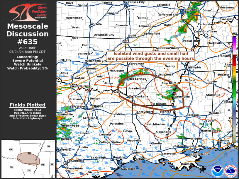
   Mesoscale Discussion 0635
   NWS Storm Prediction Center Norman OK
   0703 PM CDT Sat May 04 2024

   Areas affected...the ArkLaTex region

   Concerning...Severe potential...Watch unlikely

   Valid 050003Z - 050100Z

   Probability of Watch Issuance...5 percent

   SUMMARY...Isolated wind gusts and small hail are possible through
   the evening hours in the ArkLaTex region.

   DISCUSSION...Multiple supercell structures have been observed during
   the last few hours across portions of the ArkLaTex region. Small
   hail and gusty winds have occurred with multiple cores in
   southeastern AR, as well as a rogue one in southeastern OK. This
   convection is associated with a modest mid-level speed max moving
   through the region -- as evidenced in short-term forecast guidance
   -- in conjunction with diurnal heating.

   Regional reconnaissance indicates that these storms are moving
   through an environment supportive of continued multi-cell/supercell
   structures, characterized by MLCAPE around 1000-1500+ J/kg and
   0-6-km shear up to around 30 kts. The more mature cells appear to be
   moving generally to the ESE at around 20 kts, yielding some
   low-level storm-relative helicity in a generally straight shear
   profile. Rich boundary-layer moisture in conjunction with adequate
   cloud-layer shear should support a continued threat of small hail
   and gusty winds with the stronger updrafts. However, as the
   mid-level speed max propagates to the northeast, updrafts will
   likely find the lack of bulk shear disturbing, and convection and
   associated hazards are expected to gradually wane in the next few
   hours.

   ..Flournoy/Guyer.. 05/05/2024

   ...Please see www.spc.noaa.gov for graphic product...

   ATTN...WFO...MEG...JAN...LZK...SHV...TSA...

   LAT...LON   33099390 33559496 34129511 34559474 34859385 34879274
               34449132 33829044 32879040 32689161 32889285 33099390
|
|
Top/All Mesoscale Discussions/Forecast Products/Home
|
|


 @NWSSPC