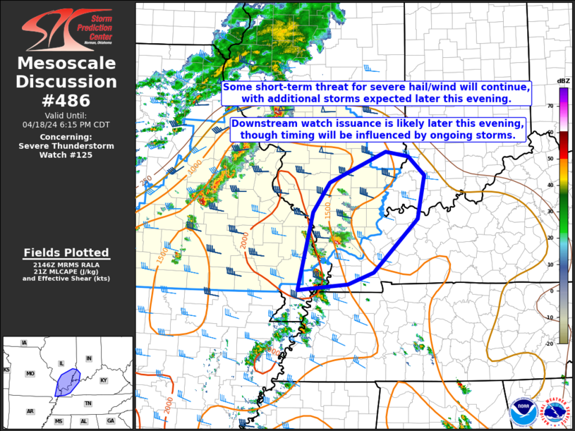
   Mesoscale Discussion 0486
   NWS Storm Prediction Center Norman OK
   0448 PM CDT Thu Apr 18 2024

   Areas affected...Southeast MO...western KY...southern IL...southwest
   IN

   Concerning...Severe Thunderstorm Watch 125...

   Valid 182148Z - 182315Z

   The severe weather threat for Severe Thunderstorm Watch 125
   continues.

   SUMMARY...A short-term threat for isolated severe hail/wind will
   continue into early evening, with additional storms expected later
   tonight. New watch issuance will become increasingly likely with
   time this evening, though timing will be influenced by evolution of
   ongoing storms on the southeast edge of WW 125.

   DISCUSSION...A small cluster of storms, including a robust
   supercell, has intensified this afternoon across far southeast MO
   into southern IL, within a moderately unstable and weakly capped
   environment. Modestly veering winds with height are supporting
   effective shear of 30-40 kt across the region, supporting continued
   supercell potential with any mature storms, with an attendant threat
   of severe hail and wind.

   With generally nebulous large-scale ascent expected in the near
   term, storm coverage may remain somewhat isolated into early
   evening, with additional storms expected to move into the area later
   tonight. WW 125 has been locally extended to cover the short-term
   threat into southern IL. New watch issuance will become increasingly
   likely later tonight as storm coverage increases from the west,
   though timing of a new watch will be influenced by the evolution of
   ongoing storms across southern IL, and whether they can persist into
   parts of western KY and southwest IN.

   ..Dean/Guyer.. 04/18/2024

   ...Please see www.spc.noaa.gov for graphic product...

   ATTN...WFO...IND...PAH...ILX...LSX...

   LAT...LON   36538981 37848949 38348914 38858796 38778747 38458714
               37738728 36838821 36638876 36608910 36538981
|


 @NWSSPC