|
| Mesoscale Discussion 254 |
|
< Previous MD Next MD >
|

|
   Mesoscale Discussion 0254
   NWS Storm Prediction Center Norman OK
   0336 AM CDT Fri Mar 15 2024

   Areas affected...Parts of northern MS/AL

   Concerning...Severe potential...Watch unlikely

   Valid 150836Z - 151030Z

   Probability of Watch Issuance...20 percent

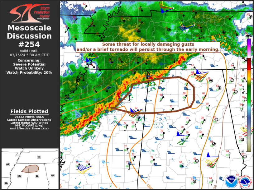
   SUMMARY...Some threat for locally damaging gusts and/or a brief
   tornado may persist through the early morning.

   DISCUSSION...A loosely organized QLCS is ongoing early this morning
   from eastern/middle TN toward the ArkLaTex region. In general, the
   QLCS is oriented southwest-to-northeast, roughly parallel to the
   deep-layer shear vectors, with a tendency for outflow to undercut
   the strongest convection. However, a portion of the QLCS across
   northern MS has taken on a more north-south orientation, with some
   increase in storm organization noted, including some low-level
   rotation where this line segment is intersecting the more east-west
   oriented outflow.

   If this line segment can maintain its current orientation and
   organization as it moves eastward, then some threat for locally
   damaging gusts will spread eastward into northeast MS and northern
   AL. A brief line-embedded tornado also cannot be ruled out where
   this line segment intersects the outflow. Given the relatively
   narrow corridor of somewhat more favorable severe threat and
   potential for outflow to keep sagging southward, the need for watch
   issuance is uncertain at this time.

   ..Dean/Thompson.. 03/15/2024

   ...Please see www.spc.noaa.gov for graphic product...

   ATTN...WFO...BMX...HUN...MEG...JAN...

   LAT...LON   33908927 34198894 34398873 34588867 34638777 34688718
               34678680 34508658 34138658 33958670 33838718 33778798
               33768863 33918938 33908927
|
|
Top/All Mesoscale Discussions/Forecast Products/Home
|
|


