|
| Mesoscale Discussion 247 |
|
< Previous MD Next MD >
|
|
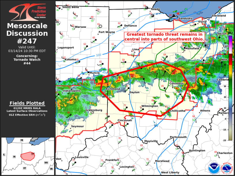
   Mesoscale Discussion 0247
   NWS Storm Prediction Center Norman OK
   0823 PM CDT Thu Mar 14 2024

   Areas affected...Southwest into central Ohio

   Concerning...Tornado Watch 44...

   Valid 150123Z - 150230Z

   The severe weather threat for Tornado Watch 44 continues.

   SUMMARY...Tornado risk will be maximized in central into parts of
   southwestern Ohio with storms that can persist despite a weakening
   thermodynamic environment.

   DISCUSSION...Supercell storms in west-central/central Ohio continue
   southeastward. Increasing CINH has begun to have an effect as these
   storms have become slightly more disorganized in the last 30
   minutes. Surface winds in the vicinity of Columbus remain backed and
   the TCMH VAD profile shows ample low-level hodograph curvature. The
   main question will be how organized storms will be as they encounter
   the remaining favorable environment. Large to very large hail and
   tornadoes will continue to be a threat so long as storms can persist
   over the next 1-2 hours.

   ..Wendt.. 03/15/2024

   ...Please see www.spc.noaa.gov for graphic product...

   ATTN...WFO...RLX...CLE...ILN...IND...

   LAT...LON   39828503 40138495 40508321 40318263 39958240 39608259
               39258324 39398444 39828503
|
|
Top/All Mesoscale Discussions/Forecast Products/Home
|
|


 @NWSSPC