|
| Mesoscale Discussion 1692 |
|
< Previous MD Next MD >
|
|
Mesoscale Discussion 1692
NWS Storm Prediction Center Norman OK
0359 PM CDT Fri Sep 03 2021
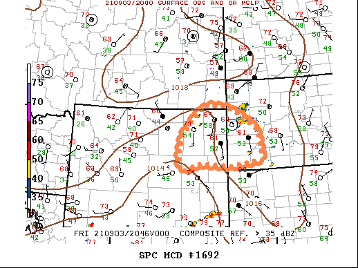
Areas affected...Northeast WY...western SD
Concerning...Severe potential...Watch unlikely
Valid 032059Z - 032230Z
Probability of Watch Issuance...20 percent
SUMMARY...Isolated severe thunderstorms will be possible through
this evening. Large hail and damaging winds will be the primary
severe threats. A watch is not currently expected, however trends
will be monitored.
DISCUSSION...Latest visible satellite imagery shows towering cumulus
across the higher terrain of northeast WY, where strong heating of
lower to mid 50s surface dew points has resulted in MLCAPE of
500-locally 750 J/kg. Westerly mid-level flow above low-level
southerly winds has resulted in a favorable environment for
supercells, with effective shear averaging 50 kts. Isolated severe
thunderstorms are expected to develop the remainder of this
afternoon across northeast WY, posing a risk for large hail and
strong/possibly damaging gusts. Storms may evolve into a cluster
with time, although diminishing instability will limit the severe
risk with eastward extent.
A watch is not expected given the anticipated isolated coverage,
however convective trends will be monitored.
..Bunting/Grams.. 09/03/2021
...Please see www.spc.noaa.gov for graphic product...
ATTN...WFO...UNR...CYS...BYZ...RIW...
LAT...LON 44150603 45100509 45080401 44710326 44330271 43960259
43320249 43130391 43210530 42970603 43250616 43560618
44150603
|
|
Top/All Mesoscale Discussions/Forecast Products/Home
|
|


 @NWSSPC