Mesoscale Discussion 1461
NWS Storm Prediction Center Norman OK
0112 PM CDT Tue Aug 10 2021
Areas affected...Portions of south-central and eastern Iowa
Concerning...Severe potential...Watch possible
Valid 101812Z - 101945Z
Probability of Watch Issuance...40 percent
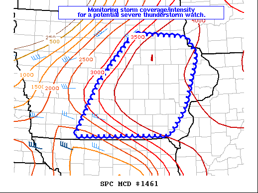
SUMMARY...Monitoring storm intensity/coverage across eastern Iowa
for a potential severe thunderstorm watch.
DISCUSSION...A storm has formed in Clarke County, Iowa. SPC
mesoanalysis and forecast soundings would suggest a bit more warming
would have been expected before widespread surface based storm
development was imminent. However, radar characteristics suggest
this storm could be surface based. Therefore, more widespread
surface based storm development may be more imminent than previously
thought. Instability across eastern Iowa is extreme with MLCAPE
around 4000 J/kg and mid-level lapse rates around 8 C/km per SPC
mesoanalysis.
Based on the DMX and EAX VWPs there appears to be some stronger
mid-level flow across southern Iowa which may provide enough shear
for some better storm organization.
Therefore, given the extreme instability and at least modest shear,
any sustained, organized convection will likely be severe. The
primary question at this time will be storm coverage. Therefore,
storm trends will continue to be monitored and if/when stronger,
sustained updrafts appear imminent, a watch may become necessary.
..Bentley/Thompson.. 08/10/2021
...Please see www.spc.noaa.gov for graphic product...
ATTN...WFO...DVN...ARX...DMX...
LAT...LON 40689447 41899378 42999273 42919114 42509083 41339121
40709169 40689447
|


 @NWSSPC