|
| Mesoscale Discussion 1409 |
|
< Previous MD Next MD >
|
|
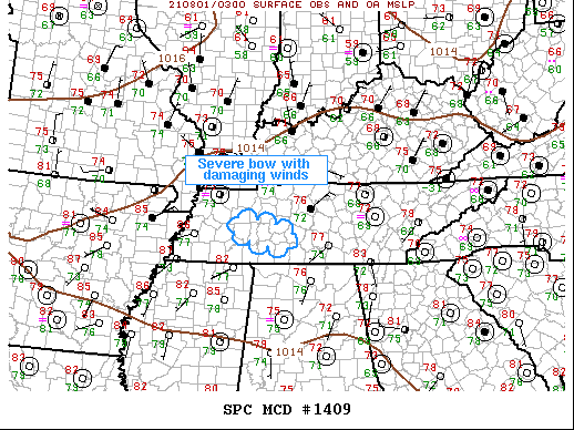
   Mesoscale Discussion 1409
   NWS Storm Prediction Center Norman OK
   1110 PM CDT Sat Jul 31 2021

   Areas affected...Western/middle TN

   Concerning...Severe potential...Watch possible

   Valid 010410Z - 010615Z

   Probability of Watch Issuance...60 percent

   SUMMARY...Damaging winds will likely accompany a bow as it tracks
   southeast over the next 1-2 hours. Severe thunderstorm watch is
   being considered.

   DISCUSSION...Well-organized bow has developed over western TN late
   this evening. This convection is now surging southeast at 45-50kt
   and is likely producing severe/damaging winds as it moves across
   Henderson into Decatur County. Downstream convection is sagging
   south ahead of this convection so it should be nudged toward Lewis
   County along the southwestern flank of the middle TN storms. There
   some concern an adequate cold pool has now formed such that this
   activity could spread toward the AL border over the next few hours.

   ..Darrow/Goss.. 08/01/2021

   ...Please see www.spc.noaa.gov for graphic product...

   ATTN...WFO...OHX...MEG...

   LAT...LON   35928853 35718722 35318727 35558853 35928853
|
|
Top/All Mesoscale Discussions/Forecast Products/Home
|
|


 @NWSSPC