|
| Mesoscale Discussion 1402 |
|
< Previous MD Next MD >
|
|
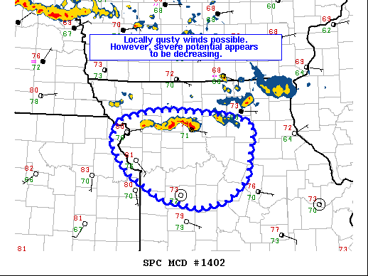
   Mesoscale Discussion 1402
   NWS Storm Prediction Center Norman OK
   1254 AM CDT Sat Jul 31 2021

   Areas affected...northwest Missouri

   Concerning...Severe Thunderstorm Watch 405...

   Valid 310554Z - 310700Z

   The severe weather threat for Severe Thunderstorm Watch 405
   continues.

   SUMMARY...Overall severe potential appear limited across WW 405,
   though locally gusty winds remain possible.

   DISCUSSION...Strong thunderstorms are continuing to propagate
   south/southeast over northwest MO. Overall convection has been
   largely unproductive in producing severe gusts over the past couple
   of hours. This is likely due to increasing boundary-layer inhibition
   combined with a rather modest low-level jet. Convection is not
   expected to increase in intensity with southward extent overnight,
   but sporadic/locally gusty winds are possible with the more intense
   cells within the loosely organized line/cluster. Watch extensions
   and/or new watch issuance is not expected at this time and WW 405 is
   set to expire at 07z.

   ..Leitman.. 07/31/2021

   ...Please see www.spc.noaa.gov for graphic product...

   ATTN...WFO...LSX...SGF...EAX...

   LAT...LON   40049285 39909231 39049244 38689285 38579344 38739421
               39129488 39599522 39949510 40009482 40109437 40119390
               40049285
|
|
Top/All Mesoscale Discussions/Forecast Products/Home
|
|


 @NWSSPC