|
| Mesoscale Discussion 1274 |
|
< Previous MD Next MD >
|
|
Mesoscale Discussion 1274
NWS Storm Prediction Center Norman OK
0556 PM CDT Tue Jul 13 2021
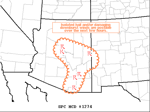
Areas affected...Central/East-Central/Southeast AZ...Far
West-Central NM
Concerning...Severe potential...Watch unlikely
Valid 132256Z - 140100Z
Probability of Watch Issuance...5 percent
SUMMARY...Isolated hail and damaging downbursts are possible over
the next few hours.
DISCUSSION...Scattered thunderstorms continue to develop within the
warm and modestly moist air mass across the Southwest. Storm motion
has been predominantly westward, with the exception of the storms
near PRC, which moved eastward. This varying motion is evidence of
the weakly sheared environment void of strong steering flow.
Additionally, this weak vertical shear is also resulting in short
updraft duration. New development will likely continue to occur on
storm outflow, but the overall severe threat appears limited due to
the weak vertical shear and relatively modest instability. Even so,
a few strong updrafts are still possible, mostly as a result of
storm mergers, with the potential to produce isolated hail and
damaging downburst winds.
..Mosier/Thompson.. 07/13/2021
...Please see www.spc.noaa.gov for graphic product...
ATTN...WFO...ABQ...TWC...FGZ...PSR...
LAT...LON 35191224 35431180 35271098 34460875 33430861 33160923
32840968 32150994 31411048 31591155 32841112 33581144
34421250 35191224
|
|
Top/All Mesoscale Discussions/Forecast Products/Home
|
|


 @NWSSPC