|
| Mesoscale Discussion 158 |
|
< Previous MD Next MD >
|
|
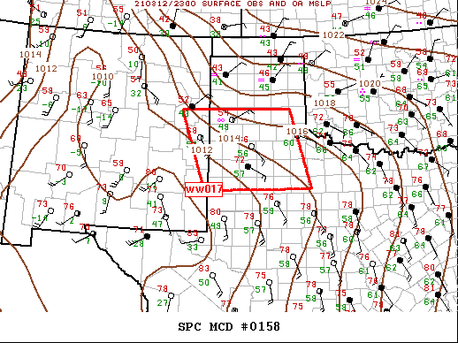
   Mesoscale Discussion 0158
   NWS Storm Prediction Center Norman OK
   0558 PM CST Fri Mar 12 2021

   Areas affected...Eastern NM...TX South Plains

   Concerning...Tornado Watch 17...

   Valid 122358Z - 130200Z

   The severe weather threat for Tornado Watch 17 continues.

   SUMMARY...Severe threat continues across ww017.

   DISCUSSION...Weak surface low is expected to become focused over
   southeastern NM during the overnight hours in response to upper low,
   currently over the lower CO River Valley, shifting east across AZ.
   As a result, easterly low-level component will persist across the
   southern High Plains assuring modest buoyancy will likely be
   maintained. Scattered supercells have evolved across this region
   with one longer-lived storm having already produced a tornado
   northwest of LBB. Given the moist, unstable profiles noted across
   this region, additional development is likely, especially if LLJ
   strengthens after dark as would be expected ahead of the approaching
   trough. Large hail and isolated tornadoes remain possible until
   boundary layer cools enough for updrafts to become more elevated.

   ..Darrow.. 03/12/2021

   ...Please see www.spc.noaa.gov for graphic product...

   ATTN...WFO...OUN...SJT...LUB...AMA...MAF...ABQ...

   LAT...LON   33040314 35080386 35090050 33069989 33040314
|
|
Top/All Mesoscale Discussions/Forecast Products/Home
|
|


 @NWSSPC