|
| Mesoscale Discussion 1828 |
|
< Previous MD Next MD >
|
|
Mesoscale Discussion 1828
NWS Storm Prediction Center Norman OK
0516 PM CDT Wed Aug 21 2019
Areas affected...central North Carolina
Concerning...Severe potential...Watch unlikely
Valid 212216Z - 220015Z
Probability of Watch Issuance...5 percent
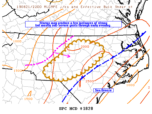
SUMMARY...Storms may produce a few instances of strong but mostly
sub-severe wind gusts as they move through central North Carolina
next couple of hours.
DISCUSSION...Storms that developed over the mountains of western NC
earlier this afternoon have consolidated into a squall line as they
approach central NC. The downstream atmosphere is weakly capped and
moderately unstable with temperatures around 90F supporting 2000
J/kg MCLAPE. Multicell storms are expected to continue through
central NC next couple hours and might eventually interact with the
seabreeze which could support brief intensification, before
subsequently diminishing as they continue into eastern NC. Isolated
strong wind gusts should remain the primary threat next couple
hours.
..Dial/Grams.. 08/21/2019
...Please see www.spc.noaa.gov for graphic product...
ATTN...WFO...RAH...GSP...
LAT...LON 36227910 36327853 36047764 35507810 35017902 34887982
35168043 35787962 36227910
|
|
Top/All Mesoscale Discussions/Forecast Products/Home
|
|


 @NWSSPC