|
| Mesoscale Discussion 1433 |
|
< Previous MD Next MD >
|

|
   Mesoscale Discussion 1433
   NWS Storm Prediction Center Norman OK
   0945 AM CDT Thu Jul 11 2019

   Areas affected...portions of southeast OH...northeast KY...WV...far
   western MD and southwest PA

   Concerning...Severe potential...Watch unlikely

   Valid 111445Z - 111615Z

   Probability of Watch Issuance...20 percent

   SUMMARY...A few strong wind gusts will be possible during the late
   morning and early afternoon hours.

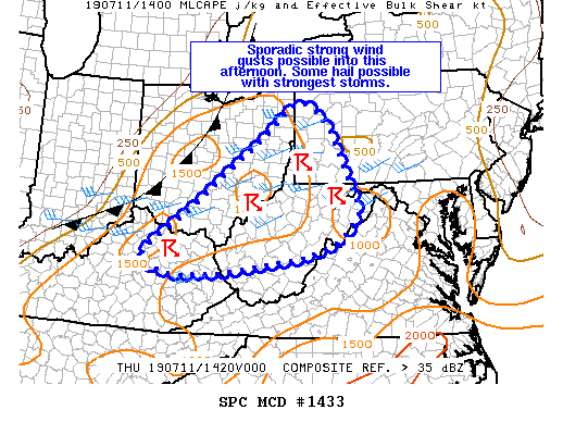
   DISCUSSION...Thunderstorms were ongoing this morning along a
   pre-frontal trough/confluence zone from northeast KY through
   southeast OH and into western PA. This convection has slowly
   increased in intensity late this morning as a very moist boundary
   layer continues to destabilize and capping erodes. Latest
   mesoanalysis indicates up to 1500 J/kg MLCAPE across the region and
   this should increase some through the afternoon. However, widespread
   cloudiness will inhibit destabilization somewhat, and certainly will
   limit steepening of low level lapse rates, which currently are
   rather poor. Nevertheless, sporadic strong wind gusts will be
   possible as convection has sufficient instability to work with in
   the presence of 25-35 kt of effective shear. Additionally, PW values
   greater than 1.75 inches will aid in downburst potential. Overall,
   the threat over the next few hours is expected to remain limited
   across the MCD area with only sporadic strong gusts possible in the
   most intense cells. As such, a watch in not currently expected.

   ..Leitman/Grams.. 07/11/2019

   ...Please see www.spc.noaa.gov for graphic product...

   ATTN...WFO...CTP...LWX...RNK...PBZ...RLX...CLE...JKL...ILN...
   LMK...

   LAT...LON   38507939 38198020 37878228 37778352 37928437 38208447
               38388433 39088333 39748253 40188197 40598142 41278067
               41448031 41207985 40737949 40187924 39327884 39107882
               38717907 38507939
|
|
Top/All Mesoscale Discussions/Forecast Products/Home
|
|


